username
X
password
register
for free!
help
  This is likely a great time to hike this trail!  Check out "Preferred" months below, keep in mind this is an estimate.
  🔥

Dupont Rim, AZ

Guide 2 Triplogs  0 Topics
  4.3 of 5  
Fav
Wish
2
details
drive
no permit
forecast
🔥
route  
stats
photos
triplogs
topics
location
44 2 0
Statistics
tap row or icons for details
Difficulty 4.5 of 5
Distance Round Trip 8.4 miles
Trailhead Elevation 5,678 feet
Elevation Gain 1,775 feet
Accumulated Gain 2,615 feet
Kokopelli Seeds 21.48
 Interest Off-Trail Hiking, Historic & Perennial Creek
feature photo
Photos Viewed All MineFollowing
Inaugural Calculation on Button Tap!
10  2017-03-11 te_wa
3  2011-04-16 ssk44
31  2011-04-16 Grasshopper
Author
author avatar Guides 16,843
Routes 17,472
Photos 24
Trips 1 map ( 6 miles )
Age 28 Male Gender
Location HAZ, TrailDEX
Associated Areas
list map done
Globe Region
Historical Weather
Trailhead Forecast
Radar Map
Expand Map
Preferred Oct, May, Apr, Sep
Sun  6:01am - 6:45pm
Official Route
 
1 Alternative
 
Historic Fire Perimetersacres
🔥 Greenback 20057.2 mi*
🔥 2012 Mistake Peak Fire5.2k
🔥 2005 Greenback7.2 mi*
🔥 View (All) - over Official Route 🔥
*perimeter length in miles


remove free decal offer

  Likely In-Season!
Guide Needed
Publish Full Detail Guide


Use +Add above to share photos and triplogs
Overview
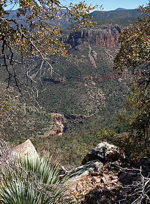
Diverse and rewarding backcountry hike into a remote region of the Salome Wilderness. The route is a combination of abandoned roadbeds and off-trail hiking. The entire off-trail segment stays within the Salome Wilderness.


  • guide related image guide related image guide related image
    guide related


Check out the Official Route and Triplogs.

Note
This is a more difficult hike. It would be unwise to attempt this without prior experience hiking.
Leave No Trace and +Add a Triplog after your hike to support this local community.
WARNING! Hiking and outdoor related sports can be dangerous. Be responsible and prepare for the trip. Study the area you are entering and plan accordingly. Dress for the current and unexpected weather changes. Take plenty of water. Never go alone. Make an itinerary with your plan(s), route(s), destination(s) and expected return time. Give your itinerary to trusted family and/or friends.

 Permit $$
None


 Directions
or
 Road
Strictly 4x4

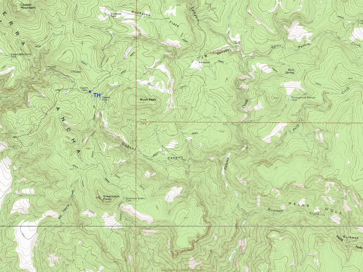
To hike
Punkin Center (Tonto Basin) - FR71 - FR236 - Destination (Dupont Cabin)
page created by ssk44 on Oct 16 2010 11:25 am
 90+° 8am - 6pm kills
helpcorrectionissue

end of page marker