 Route Editor

| Guide | ♦ | 19 Triplogs | 3 Topics |
details | drive | no permit | forecast | route |
stats |
photos | triplogs | topics | location |
| 79 | 19 | 3 |
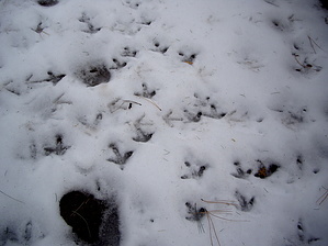
A Turkey of a Hike... by imike Starting off of West Side Road (a bit over 10 miles in from High Rolls) the first half mile of the trail winds around the edge of a grassy meadow, fenced off and maintained as a water collection basin by the Alamogordo City Water District. You will intersect T111 (Atkinson Canyon Trail) towards the end of the fenced off area. It moves off to your right up to Atkinson Meadow. At the upper end of this large field, often frequented by Turkey, Deer and Elk, the trail follows the old water district maintenance track up a bit more steeply through the forest, gaining over 500' over the next mile. At the end of that mile, the trail intersects T110 (Pipeline trail), which also moves off to your right to climb up to Atkinson Meadow, terminating up at the Rim Trail (T105) at the same spot with T111.
You may walk the road back towards the Rim Trail to create a variety of looping hikes, or if starting your outing from this upper trailhead, it can be reached from Cloudcroft by driving just under 2 miles out of the Village on NM130... turning right on Sunspot Hiway (NM 6563) and following it for a bit over 6 miles, driving a little past the large meadow at the Upper Karr Canyon rest stop, and turning right onto FR 64D, Alamo Peak Road. Follow this very narrow (one lane!) paved road to its end, driving very slowly. For a brisk, energetic outing...this is one of the nicer trails to enjoy. Winter time may find the upper regions snowed in, but the roads are usually plowed. West Side Road could be tricky during the thaw/refreeze cycle. Mud and ice can make for a poor combination for driving. Check out the Official Route and Triplogs. Leave No Trace and +Add a Triplog after your hike to support this local community. One-Way Notice This hike is listed as One-Way. When hiking several trails on a single "hike", log it with a generic name that describes the hike. Then link the trails traveled, check out the example. | ||||||||||||||||||||||||||||||||||||||||||||||||||||||||||||||||||||||||||||||||||||||||||||


