 Route Editor

| Guide | ♦ | 4 Triplogs | 0 Topics |
details | drive | no permit | forecast | route |
stats |
photos | triplogs | topics | location |
| 29 | 4 | 0 |
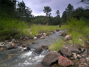
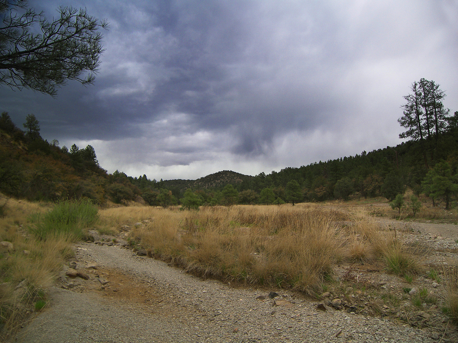
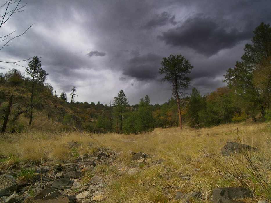
Carboniferous crusade by PrestonSands   Overview: This description is of a short hike down lower Coal Creek canyon, which runs along the Arizona-New Mexico border in the Big Lue Mountains. Specifically, this hike is along the lower portion of the creek, north of state highway 78, near Coal Creek Campground. The hike follows an ATV trail along Coal Creek/s seasonal watercourse to a small park among tall ponderosa pines. Overview: This description is of a short hike down lower Coal Creek canyon, which runs along the Arizona-New Mexico border in the Big Lue Mountains. Specifically, this hike is along the lower portion of the creek, north of state highway 78, near Coal Creek Campground. The hike follows an ATV trail along Coal Creek/s seasonal watercourse to a small park among tall ponderosa pines.Lower Coal Creek is a conveniently located hike for those camping at Coal Creek Campground or merely passing through the area. Mileage listed in the statistics is for a hike from Coal Creek Campground to the end of the ATV trail and back. It is also possible to continue further down Coal Creek Canyon for a longer hike.
Hike: Along highway 78, one-tenth of a mile west of Coal Creek Campground, an unmarked dirt road heads north from the highway (33.10426, -109.06369) into an open camping area. Follow this road northwest through a little valley, along the route of Coal Creek. One-third of a mile from Coal Creek Campground, the valley narrows into a canyon, and the road (now a jeep trail) passes through a barbed wire gate (33.10666, -109.06571) into a grassy, open forest of pine and juniper. A short distance past the gate is a side road splitting off to the right that goes uphill. Stay left, in the canyon bottom. The jeep trail soon crosses over to the west bank of Coal Creek and immediately deteriorates into a narrow ATV trail. There are several more creek crossings as the route travels down the meandering canyon. At about the one-mile point, the canyon makes a sharp turn to the south, and the trail terminates in a small, grassy park, shaded on the edges by tall ponderosa pines. There is a little flat along the creek at this point, perfect for camping. If you choose to hike further down the canyon, Coal Creek cuts an ever-deepening channel into the basaltic bedrock, and water-loving species such as ash and grapevine appear. Coal Creek eventually empties into the San Francisco River, many miles down the canyon. Canyoneering skills may be required in some places. Otherwise, return the way you came. Gate Policy: If a gate is closed upon arrival, leave it closed after you go through. If it is open, leave it open. Leaving a closed gate open may put cattle in danger. Closing an open gate may cut them off from water. Please be respectful, leave gates as found. The exception is signage on the gate directing you otherwise. Check out the Official Route and Triplogs. Leave No Trace and +Add a Triplog after your hike to support this local community. | ||||||||||||||||||||||||||||||||||||||||||||||||||||||||||||||||||||||||||||||||||


