username
X
password
register
for free!
help
  🔥

Praying Hands - Crosscut TH, AZ

Guide 51 Triplogs  0 Topics
  3.2 of 5  
Fav
Wish
0
details
drive
no permit
forecast
🔥
route  
stats
photos
triplogs
topics
location
368 51 0
Statistics
tap row or icons for details
Difficulty 2 of 5
Distance Round Trip 4.2 miles
Trailhead Elevation 2,119 feet
Elevation Gain 900 feet
Accumulated Gain 920 feet
Kokopelli Seeds 8.8
 Interest Off-Trail Hiking
unreported if dogs are allowed
editedit > ops > dogs to adjust
feature photo
Photos Viewed All MineFollowing
Will recalculate on button tap!
25  2022-02-19
Massacre Arch via First Water Trailhead
John10s
10  2020-09-10 AZLumberjack
5  2020-03-03
Crosscut-Treasure-Praying Hands loop
The_Eagle
15  2019-02-27
Canyon of the Waterfalls & Massacre Falls
DixieFlyer
6  2019-02-23
Hands WFFWC Loop
hikerdw
10  2019-02-16
Hackberry - Prospector - Baby Willow Loop
joebartels
11  2019-02-16
Crosscut Prospector Praying Hands Loop
The_Eagle
29  2019-02-05
Praying Bear Falls Loop
mr_squishy
Page 1,  2,  3,  4,  5
Author
author avatar Guides 16,843
Routes 17,472
Photos 24
Trips 1 map ( 6 miles )
Age 28 Male Gender
Location HAZ, TrailDEX
Associated Areas
list map done
Phoenix Region
Historical Weather
Trailhead Forecast
Radar Map
Expand Map
Preferred Jan, Feb, Mar, Apr
Sun  6:02am - 6:46pm
Official Route & 4 Rts
 
11 Alternative
 
Historic Fire Perimetersacres
🔥 2024 Siphon Fire35.9 mi*
🔥 2020 Superstition Fire9.6k
🔥 View (All) - over Official Route 🔥
*perimeter length in miles


remove free decal offer

Guide Needed
Publish Full Detail Guide


Use +Add above to share photos and triplogs
Overview
Follows Jacob's Trail #58 to a social trail that leads up near the Praying Hands. Out-and-back variation on the "Praying Hands Loop" hike.


    Check out the Official Route and Triplogs.
    Leave No Trace and +Add a Triplog after your hike to support this local community.
    WARNING! Hiking and outdoor related sports can be dangerous. Be responsible and prepare for the trip. Study the area you are entering and plan accordingly. Dress for the current and unexpected weather changes. Take plenty of water. Never go alone. Make an itinerary with your plan(s), route(s), destination(s) and expected return time. Give your itinerary to trusted family and/or friends.

     Permit $$
    None


     Directions
    or
     Road
    FR / Dirt Road / Gravel - Car Okay

    To Crosscut Trailhead
    From Mesa:
    Follow US 60 east to Idaho Road. Turn North onto Idaho Road which is SR88 and follow it North 2.2 miles. SR88 bends right just past Scenic St. and Idaho continues North. Be sure to go right and stay on SR88. Follow SR88 5.2 miles to the signed turnoff for First Water Trailhead(large brown sign), this is FR78. Turn right onto FR78 and follow 0.6 miles to the large dirt parking lot which is the Crosscut Trailhead.

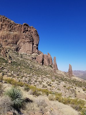
    FR 78 is graded and passable for most low-clearance 2WD cars, but could be difficult after heavy summer rains. This trailhead is the traditional one for trail #58 and is frequently used as the fee-free alternative to hike the Flatiron and such.

    From US 60 West: (Gold Canyon, Superior, etc)
    Take Mountain View Rd north instead of Idaho Rd to save 5-6 miles. The turn for Mountain View Rd comes quickly after Silly Mountain. Turn right onto SR88.

    Tip:
    The crucial right turn onto FR78, is exactly 1 mile after the turn to Lost Dutchman.

    From PHX (I-10 & AZ-51) 41.1 mi - about 52 mins
    From TUC (Jct 1-10 & Grant) 134 mi - about 2 hours 9 mins
    From FLG (Jct I-17 & I-40) 185 mi - about 2 hours 56 mins
    page created by hippiepunkpirate on Nov 26 2010 8:44 pm
     90+° 8am - 6pm kills
    helpcorrectionissue

    end of page marker