| Guide | ♦ | 27 Triplogs | 1 Topic |
details | drive | no permit | forecast | 🔥 route |
stats |
photos | triplogs | topic | location |
| 22 | 27 | 1 |
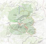
Suburban Excursion by Jim  The Elden Environmental Study Area is a small collection of trails forming various loops at the base of Mount Elden. Access is found at the end of a culdesac in a neighborhood in east Flagstaff. The area is popular with people walking their dogs and passing through on the Pipeline trail, which runs along the south end. One trail leads to the large crack or canyon, which divides Mount Elden in two. Therefore, you can use the trailhead to access that canyon for a scramble to the summit of Elden. The Elden Environmental Study Area is a small collection of trails forming various loops at the base of Mount Elden. Access is found at the end of a culdesac in a neighborhood in east Flagstaff. The area is popular with people walking their dogs and passing through on the Pipeline trail, which runs along the south end. One trail leads to the large crack or canyon, which divides Mount Elden in two. Therefore, you can use the trailhead to access that canyon for a scramble to the summit of Elden.The Elden Environmental Study Area is a collection of small official trails and social trails that form various loops. Some of these have names like "Forces of nature" or "Walk through time". A map at the trailhead names them and shows where they supposedly go, but time and people have changed the trail pattern and added numerous short connectors. None of the trails are long, and because you are sandwiched between Mount Elden and the Pipeline Trail, you really can not get lost. I used to have a friend who lived over in east Flag and walked his dog out here. The loop he used took about 15 minutes and went for around 1/2 a mile. Your trip will vary depending on the trails you take.
The most enjoyable time of year for the area, being that it is Flagstaff, is probably summer, but it can be nice out here year-round. Following heavy snows, this is a decent area for short snowshoe or cross country ski trips, and due to its southern exposure, it melts off fast so it can be dry when other trails are still snow-covered. Check out the Official Route and Triplogs. Leave No Trace and +Add a Triplog after your hike to support this local community. | ||||||||||||||||||||||||||||||||||||||||||||||||||||||||||||||||||||||||||||||||||||||||||||
 Route Editor


