If you're really into working up a good sweat, then the Y Bar (aka Shake Tree) is the trail for you. As far as a climb goes, it blows the barn doors off the Barnhardt Trail, its northerly neighbor. Unfortunately, it's not quite as scenic as Barnhardt. So unless you're lucky enough to find "Ron and John's Secret Swimming Hole(s)" or just want a killer workout, it's not the most rewarding hike in the area (boy, have I ever gotten spoiled!).
The hike goes from Barnhardt Trailhead and proceeds mostly uphill for 5.5mi through Y Bar Basin and on up to the intersection with the Mazatzal Divide Trail at Windsor Spring.
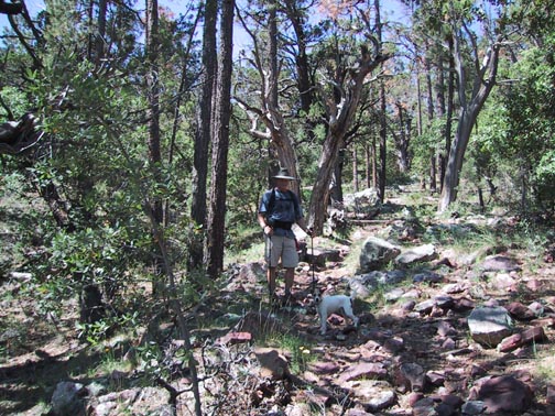
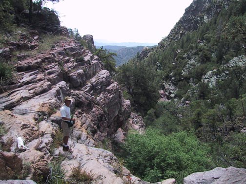
The trail is well worn and quite easy to follow. It doesn't waste any time with a warm-up. You start with a gradual to moderate climb through desert scrub and then begin a turn to the south, continuing to climb along the contours of Suicide Ridge. The trail tends to be very rocky so pay close attention to your footing. You'll pass through about four or five ravines before you turn once again to the west, climbing along the north side of Shake Tree Canyon where you'll notice some nice rock formations on the other side. As you continue to gain elevation, you'll go from Prickly Pear to Juniper and Pinon, then to Ponderosa and even some Douglas firs.
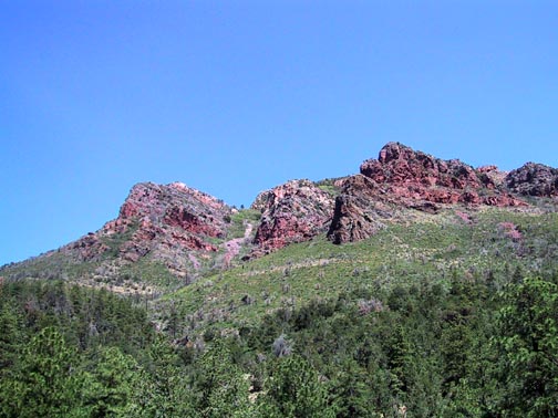
At about 3.75mi/6300", Cactus Saddle is a good place to take a breather. In his book "Hiking Arizona's Superstition and Mazatzal Country," Grubb suggests climbing to the top of Maz Peak by following the ridgeline up from this point. To say that it looks a bit imposing would be the understatement of the year. When I get a chance to give it a try, I believe I'll try an alternate route.
As you begin to descend into Y Bar Basin, you will be rewarded with great views of the west face of Mazzie Peak. At about 4.5mi, Y Bar Tanks is a seep spring you will encounter at the bottom of the basin. Continue to bear to the right, and the trail will once again begin a rather arduous climb to Windsor Saddle and the Maz Divide Trail at 5.5mi/6550'. Fortunately, the area is well forested, and shade is abundant.
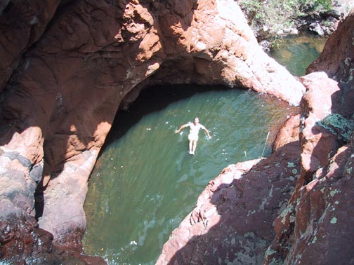
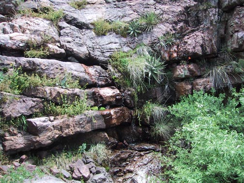
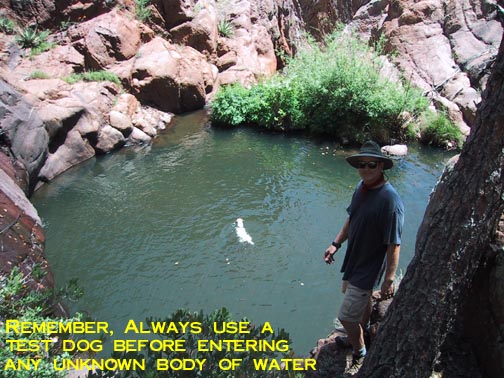
My partner and I happened to stumble upon the most awesome complex of cascading swimming holes while exploring the area. As any hiking photographer will testify, these pictures just can't do the heights and depths any justice. The water was so deep in spots that we didn't touch bottom even when jumping in from about 15 feet. It took some tricky climbing and a creative route to get down to one and then the other.
Although I'm sworn to an oath of secrecy regarding the location of Ron & John's Swim Holes, with a little tenacity, they shouldn't be too hard to find. One clue: there is no trail or sign of any recent use. One reason may be that the "price of admission" to get there is so steep (get it? :)
When hiking several trails on a single "hike", log it with a generic name that describes the hike. Then link the trails traveled, check out the example.
WARNING! Hiking and outdoor related sports can be dangerous. Be responsible and prepare for the trip. Study the area you are entering and plan accordingly. Dress for the current and unexpected weather changes. Take plenty of water. Never go alone. Make an itinerary with your plan(s), route(s), destination(s) and expected return time. Give your itinerary to trusted family and/or friends.
Permit $$
None
Directions
Road
FR / Jeep Road - Car possible when dry
To Barnhardt Trailhead From the corner of SR87 & SR260 in Payson go south on SR87 for 14.5 miles to the signed turnoff for Barnhardt trailhead (forest road 419). Follow FR419 5 miles to its end. The parking area is fairly large. Barnhardt trailhead is located at the west end of the parking area. From Phoenix take SR87 north out of Mesa to Payson. The turnoff to the trailhead is 4mi north of the 188 intersection. (think rest stop)
From PHX (I-10 & AZ-51) 83.4 mi - about 1 hour 45 mins From TUC (Jct 1-10 & Grant) 182 mi - about 3 hours 4 mins From FLG (Jct I-17 & I-40) 126 mi - about 2 hours 31 mins
 Route Editor


 Note: Page stats reflect one-way.


