 Route Editor

| Guide | ♦ | 6 Triplogs | 0 Topics |
details | drive | no permit | forecast | route |
stats |
photos | triplogs | topics | location |
| 26 | 6 | 0 |
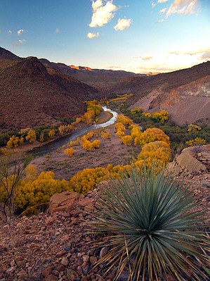
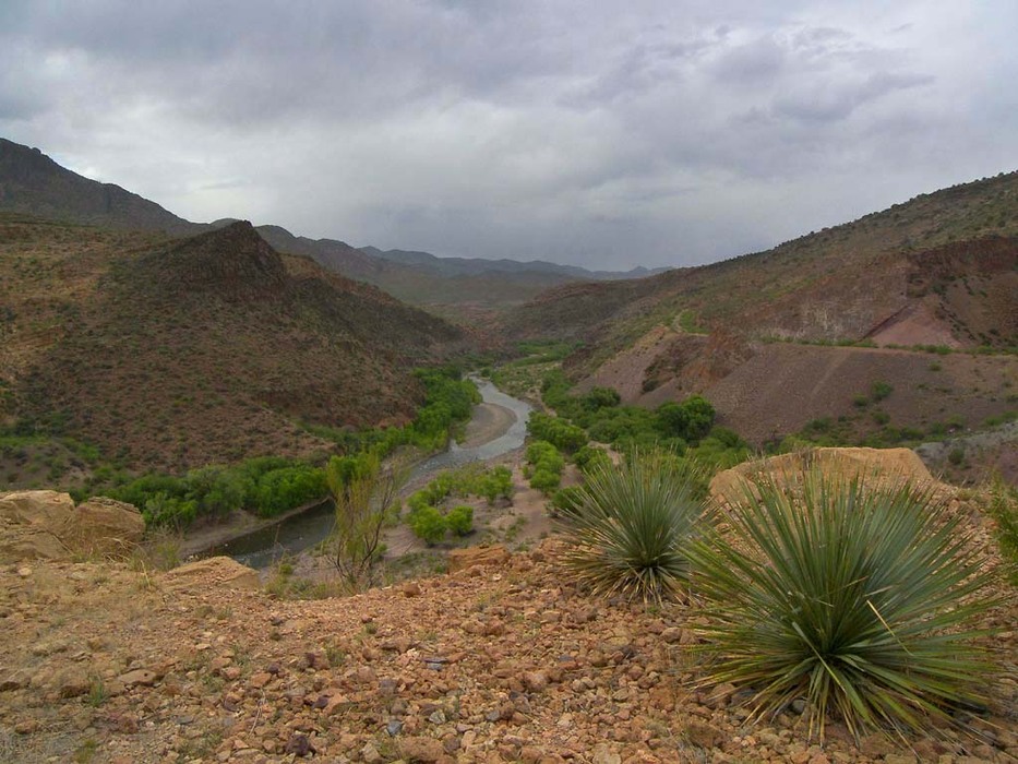
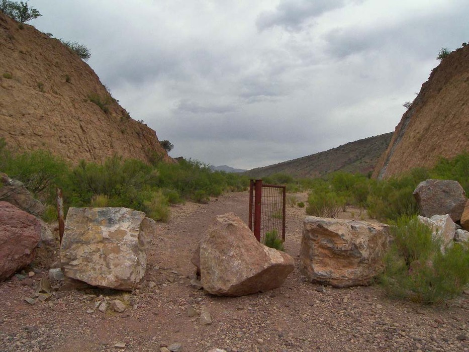
Frisco Fun by PrestonSands  Overview OverviewThis hike follows the roadbed of an aborted highway project from half a century ago, along the San Francisco River in eastern Arizona. Swimming possibilities, interesting geology, and far-reaching views of the colorful San Francisco River canyon are the incentives for this short and easy hike. Hike At the end of the San Francisco River Road, a gate and some large boulders stop motor vehicles from continuing further. Park here, hike past the boulder blockade, and continue down the old highway grade. The hike immediately runs through a deep road cut, then emerges onto a shelf-like grade, a couple of hundred feet above the San Francisco River. Outstanding views of the San Francisco River canyon begin at this point, and continue for the rest of the hike, with the grade staying high above the river. Large mesquite trees and cacti cover the wide grade of the old highway, funneling you onto a pathway at its center.
The old highway grade and this hike both come to an end at 0.9 miles, where the highway crew ran out of money. A cow path leads a short distance further before it too comes to an end on a steep hillside above the River. If you pick your route carefully from the end of the road or the cow path, you may be able to descend the steep hillside down to the San Francisco River, where there are excellent opportunities for swimming. Choose your route carefully, as there are hidden cliffs in some places. The river bottom in this area has numerous sites for camping, among the cottonwood groves. A popular 4x4 road runs along the San Francisco River, which could provide an alternate return route. This 4x4 road connects with the San Francisco River Road at the beginning of this hike, next to the roadblock. Otherwise, return via the highway grade. Gate Policy: If a gate is closed upon arrival, leave it closed after you go through. If it is open, leave it open. Leaving a closed gate open may put cattle in danger. Closing an open gate may cut them off from water. Please be respectful, leave gates as found. The exception is signage on the gate directing you otherwise. Check out the Official Route and Triplogs. Leave No Trace and +Add a Triplog after your hike to support this local community. | |||||||||||||||||||||||||||||||||||||||||||||||||||||||||||||||||||||||||||||||||||||


