Route Editor

| Guide | ♦ | 11 Triplogs | 0 Topics |
details | drive | no permit | forecast | route |
stats |
photos | triplogs | topics | location |
| 68 | 11 | 0 |
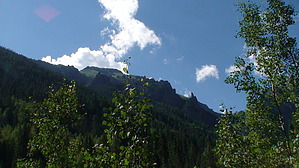
Pretty and Prettier by slegal The trail starts out at the south end of South Pine St. Here the trail is more of a dirt road. There are old mines dotting the mountains above Bear Creek Canyon, so this old road was undoubtedly an access point for many of these mines.
As you get further up into the canyon the mountains on either side of the trail get taller and steeper. To your right is the Telluride Ski Area, although you won't see any ski lifts or runs from the trail. As you get higher the creek gets closer to trail level. Then Lower Bear Creek Falls comes into view. Don't confuse this waterfall with the upper waterfall. The upper waterfall is even prettier. After 2.5 miles and a little over 1,000 vertical feet you reach the end of the trail and the base of Upper Bear Creek Falls. Take in the views and enjoy the waterfall. Check out the Official Route and Triplogs. Note This is a more difficult hike. It would be unwise to attempt this without prior experience hiking. Leave No Trace and +Add a Triplog after your hike to support this local community. | |||||||||||||||||||||||||||||||||||||||||||||||||||||||||||||||||||||||||||||||||||||||||