Route Editor

| Guide | ♦ | 13 Triplogs | 1 Topic |
details | drive | no permit | forecast | route |
stats |
photos | triplogs | topic | location |
| 198 | 13 | 1 |
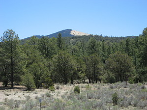
Easiest of the four sacred peaks by Jim Think of Mount Taylor as Humphrey's little brother: another strato-volcano like the San Francisco Peaks that blew itself out sometime in the past. It's 1300 feet lower than Humphrey, so it is a much easier hike and is going to be much milder on the summit. It's not in a wilderness area, so you might even bike it if you want to.
Around 1000 feet beyond the cow tanks the trail turns to the right and upslope to leave the valley which is now about 150 feet deep. There is more than one trail going up through the trees, but again they all seem to lead to the main trail that heads up the gentle grassy slope to a prominent ridge. The trail is in a very pretty area and is also rather eroded at this point, but nothing you can't walk on. From the top of the saddle on the ridge the trail becomes what a hiker would consider a well developed hiking trail. It is now a nice single track and follows a series of long, gentle switchbacks that head for the summit of Mount Taylor. From the saddle you lose all the ponderosa pine and douglas fir that you previously had and walk in a wide open expanse of grass and scattered groves of engelmann spruce. These groves are never very large and would not offer any real protection during a summer lightning storm, which are as common to Mount Taylor as they are to the San Francisco Peaks. This is a fairly short hike, but you should try to be off the summit by noon on a typical monsoon day. The summit has a sign on it and is 11,301 feet above mean sea level. You might not think it is this high, since it is a pretty easy hike up. Cows abound on this hike and appeared to be everywhere I wanted to be. They were afraid of me, so it did not pose a problem. In fact, the most serious concern they created were the number of barbed wire fences that you will have to go through to reach the summit. Be careful around the tanks. The cows loved to congregate there for water (the grass was especially green there too) and this meant lots of cow presents for every boy and girl! Roads are closed in winter when snow covered, but there is a race which is held in mid-winter that ascends Mount Taylor. This mountain is probably pretty easy to climb in winter as a long day of snowshoeing or cross-country skiing. Check out the Official Route and Triplogs. Leave No Trace and +Add a Triplog after your hike to support this local community. | ||||||||||||||||||||||||||||||||||||||||||||||||||||||||||||||||||||||||||||||||||||||||||||