Route Editor

| Guide | ♦ | 117 Triplogs | 0 Topics |
details | drive | no permit | forecast | route |
stats |
photos | triplogs | topics | location |
| 30 | 117 | 0 |
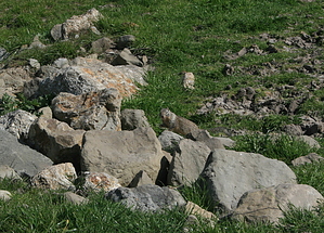
Ground Squirrel Heaven by JimmyLyding  Begin at the Orchard Staging Area, the grassy parking area roughly 1/4 mile from Castle Rock Road. Head due south through the cattle gate, and a large ranch will be to your left across the road, and a grassy hill looms on your right. I've seen coyotes several times on this hill. You quickly reach a junction: head left to continue on the Castle Rock Trail, or go right to reach the Shell Ridge Loop Trail. After turning right, you begin a steady ascent to the top of Shell Ridge. 1/4 mile from the junction, you reach another junction. Turning right takes you north on the Borges Ranch Trail and back to Castle Rock Road, but you want to turn left to remain on Shell Ridge Loop.
You have been traveling through a mixture of mixed oak savannahs and deep oak forests until this point. When you reach the Briones-Mount Diablo Regional Trail, you enter a world of wide-open grasslands. This is the kingdom of the California ground squirrel. These are very large squirrels that live in burrows, and you are likely to see hundreds of them before you re-enter the forest 2 miles to the southeast. These beasties form the basis of a large biotic food web in the area. Coyotes are all over the place, rattlesnakes lurk in the dense brush, and it's impossible not to notice the myriad raptors soaring overhead. You may think that these squirrels are merely helpless prey for this suite of predators, and you'd be wrong. They stand on their hind legs in front of their burrows, keeping both eyes trained on any coyote in the area. They kick sand in snakes' faces, rub themselves on snakeskin to confuse the snake's sense of smell, and even directly confront these predators with their large bushy tails above their bodies to make themselves appear too large to eat. Their eyes are trained continuously skyward on the lookout for red tail hawks. Alas, many many ground squirrels fall prey to these predators, and the numerous turkey vultures are there to clean up after a kill. The Briones-Mount Diablo Regional Trail continues along the spine of Shell Ridge to the southeast through these grasslands. I'm not kidding when I claim that you're likely to see hundreds of ground squirrels, and you'll undoubtedly also see a few cows. This is not a hike for warm weather since there is almost no shade. You eventually reach a junction with the Wall Point Road (actually a fire road typically only used by hikers and mountain bikers). Above this junction is the China Wall, a collection of sandstone monoliths that jut out of the underlying grassland like a dragon's teeth. The Wall Point Road continues almost level before you turn left onto Dusty Road (another fire road). The Wall Point Road continues to the southeast if you're interested in a longer loop. Dusty Road travels through a dense forest of oak and Coulter pines. The Coulter pine has the most massive cone of any pine species, and you would be in serious trouble if one hit you on the head. They commonly weigh 5 pounds, but the good news is that Coulter pines don't grow very tall, so a falling cone wouldn't be moving too fast by the time it bonked you on the noggin. Dusty Road reaches the bottom of Pine Canyon about 0.5 miles after branching off from Wall Point Road: go right if you want to head up to the high country of Mount Diablo, but turn left to return to the trailhead. The trail along the bottom of Pine Canyon is Stage Road (fire road), and it follows Pine Creek. You'll cross that creek at least six times, and some of them are reasonably scary when the water is flowing well in the spring. You travel roughly 2 miles northwest on Stage Road before reaching a junction with the Shell Ridge Loop Trail. A few hundred yards past this junction, branch off of Stage Road go veer to the left at a fork. Going right takes you down to the bottom of Pine Creek and the ball fields, swimming pool, and picnic areas at Castle Rock Regional Recreation Area. Veering left takes you through a dense forest of oak before reaching the cattle gate at the Orchard Staging Area's south end. Gate Policy: If a gate is closed upon arrival, leave it closed after you go through. If it is open, leave it open. Leaving a closed gate open may put cattle in danger. Closing an open gate may cut them off from water. Please be respectful, leave gates as found. The exception is signage on the gate directing you otherwise. Check out the Official Route and Triplogs. Leave No Trace and +Add a Triplog after your hike to support this local community. | |||||||||||||||||||||||||||||||||||||||||||||||||||||||||||||||||||||||||||||||||||||