 Route Editor

| Guide | ♦ | 12 Triplogs | 1 Topic |
details | drive | no permit | forecast | 🔥 route |
stats |
photos | triplogs | topic | location |
| 98 | 12 | 1 |
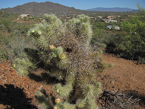
Urban trail on the fringe by DarthStiller  The Maricopa Trail is a project in progress that will connect all the Maricopa County parks by a trail that forms a loop around the county. This section from New River Road to I-17 is very unremarkable but can still provide some easy mileage with low AEG. The Maricopa Trail is a project in progress that will connect all the Maricopa County parks by a trail that forms a loop around the county. This section from New River Road to I-17 is very unremarkable but can still provide some easy mileage with low AEG.Start at the newly built Spear S Ranch Trailhead. This trailhead was constructed and dedicated some time in 2011 and is located on the east side of New River Road. A wooden fence and gate are located on the north side of the parking lot with a prominent "MT" marking. Take the spur trail out and turn left, heading west. Within a few yards, the singletrack trail crosses New River Road and parallels Linda Lane, an unmaintained dirt road. To your right (north) are some trailers and quirky homes in a valley below you.
At about one mile in, both the trail and Linda Lane descend into a wash and underneath some very prominent power lines. Linda Lane fades away at this point, and the trail morphs into the many ATV trails in this area, heading southwest. The trail is always marked by the Maricopa Trail "MT" markers, although sometimes the signs are gone, and only the metal posts remain. The markers are usually placed at (or just beyond) major junctions with other ATV trails. The trail crosses Skunk Creek in a few areas as it generally parallels it. The wash crossings are marked very well for either direction you may be traveling in. The vegetation at this point is mostly mesquite, Palo Verdes, and creosote. There are also prominent signs of equestrian use. At just under 3 miles, there is a "T"-junction which will take you to the Anthem TH off of 11th Avenue and Desert Hills Drive. The vegetation has thinned out here a lot, and the huge cell tower adjacent to the TH lot is easy to spot. To the right and even behind you at this point is the southern edge of Anthem, with Daisy Mountain behind that. The trail continues southwest until it crosses Skunk Wash for the final time. Skunk Creek is very wide and sandy at this crossing and affords some lovely views to the north devoid of the otherwise ubiquitous development. After the creek crossing, the trail heads directly west along a strip of largely undeveloped land about a highway median width. To the left (south) is Desert Hills Drive and some non-HOA housing, mostly new and most with corrals. To the right (north) is Meridian Drive and Anthem. The only driveable road that connects these roads is accessible only by emergency vehicles. Fencing and wire are on both sides of the "median", but there are several spurs trails every half mile or so to allow access from both neighborhoods. The vegetation remains mostly mesquite, Palo Verdes, and creosote and not very consistent in terms of thickness or thinness. As you head west, Gavilan Peak is visible to the north, and the Bradshaws further past that. To the north, you will pass a church and then a shopping center, at which point the trail goes under the Gavilan Peak Parkway. After another 0.6 miles, the trail goes under I-17 and to Pioneer Road. From Pioneer Road, the trail continues to the west, but if you head back now, your roundtrip distance will be just over 13 miles. As of May 2011, no trailhead has been built at Pioneer Road, but there appears to be plentiful parking available here if you want to try the hike the other direction or go out to Lake Pleasant from here. Accessing this area by car seems very easy by taking the Pioneer Road exit off I-17 one mile to the south. It also might not be a bad idea to park at the shopping center off the highway and adding an extra half-mile of hiking for more secure parking. Gate Policy: If a gate is closed upon arrival, leave it closed after you go through. If it is open, leave it open. Leaving a closed gate open may put cattle in danger. Closing an open gate may cut them off from water. Please be respectful, leave gates as found. The exception is signage on the gate directing you otherwise.
Check out the Official Route and Triplogs. Leave No Trace and +Add a Triplog after your hike to support this local community. One-Way Notice This hike is listed as One-Way. When hiking several trails on a single "hike", log it with a generic name that describes the hike. Then link the trails traveled, check out the example. | ||||||||||||||||||||||||||||||||||||||||||||||||||||||||||||||||||||||||||||||||||||||||||||||||||||||||||||||||||||||||||||||||||||||||||||||||||||||||||||||||||||||||||||||||||||||||||||||||


