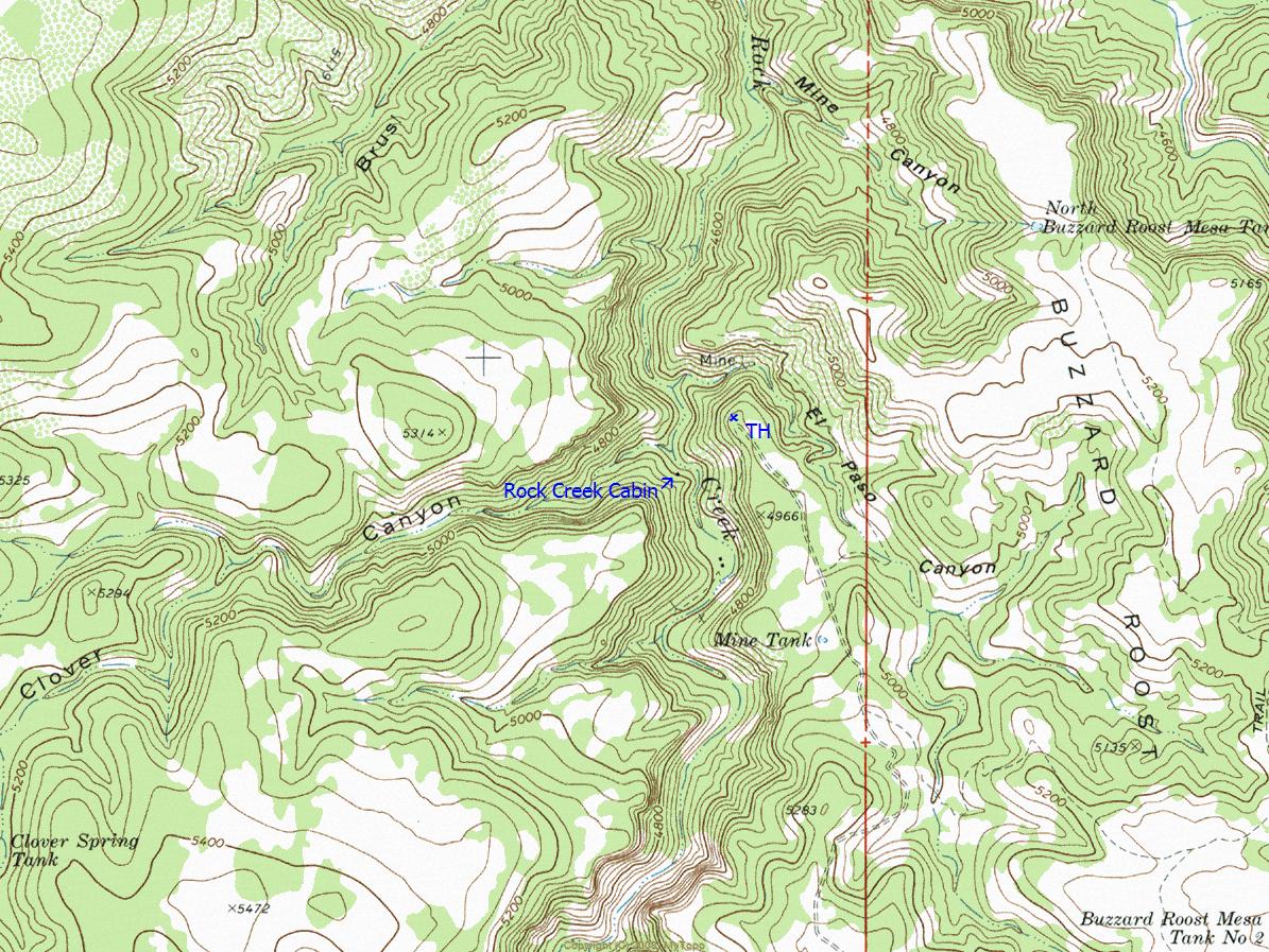
Remote and easy to navigate old abandoned ranch road down to perennial and sycamore tree-lined Rock Creek.
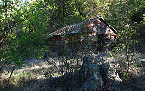
Hike down Rock Creek a short distance to view this historic, late 19th century-early 20th-century original ranching log cabin (at waypoint N34.03812 W-111.07653).
Note: To justify this long day drive to/from, if qualified to hike, it is recommended that you "first" do the day hike to summit HAZ Hike Description - Jerky Butte and "second" drive the additional miles up FR486 and FR485 to hike Rock Creek Cabin; These two drives with hikes will make for a very long, but most rewarding day out in our remote Sierra Ancha Mountains.
WARNING! Hiking and outdoor related sports can be dangerous. Be responsible and prepare for the trip. Study the area you are entering and plan accordingly. Dress for the current and unexpected weather changes. Take plenty of water. Never go alone. Make an itinerary with your plan(s), route(s), destination(s) and expected return time. Give your itinerary to trusted family and/or friends.
Permit $$
None
Directions
Road
Strictly 4x4
To hike From Phoenix
Hwy 60 to Globe to Hwy 188 to Hwy 288 to the intersection of Hwy 288/FR486; High Clearance OK when dry on FR486 to the unmarked intersection with high clearance 4x4 only FR485; FR485 to end at TH/Park--> N34.03963 W-111.07425; (For your reference and download see posted GPS Track Driving Route to TH/Parking starting from Hwy 288/FR486 intersection);
page created by Grasshopper on May 15 2011 11:28 pm
 Route Editor


 Remote and easy to navigate old abandoned ranch road down to perennial and sycamore tree-lined Rock Creek.