Route Editor

| Guide | ♦ | 4 Triplogs | 0 Topics |
details | drive | no permit | forecast | route |
stats |
photos | triplogs | topics | location |
| 24 | 4 | 0 |
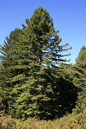
Major Redwood Action by JimmyLyding  The hike heads downhill from the trailhead on a short 0.3 mile spur trail to the beginnings of the North Ridge and Harkins Ridge Trails. Both trails end at the Higgins Canyon Road / Purisima Creek Road parking area at the junction of the Whittemore Gulch, Purisima Creek, and Walker Gulch drainages 1500' below. Harkins Ridge takes 3.0 miles to get to the other trailhead, and taking North Ridge before joining Whittemore Gulch Trails is 3.6 miles. However, Harkins Ridge has steep downhill portions that drop hundreds of feet punctuated by relatively flat stretches while Whittemore Gulch / North Ridge is a relatively mellow grade from top to bottom. There is also another 0.5 mile spur trail from the trailhead to the junction just north of the 0.3 mile spur.
I went right onto Harkins Ridge (not knowing the respective grades of either route) to begin a steep descent. Harkins Ridge is a fire road that drops steeply over a route that features both steep and mellow stretches. 200 yards of steep descent followed by 100 yards of flat trail are the norm until it switchbacks to the east after about a mile. The flora here consists of a mosaic of Douglas fir, California bay, and tanoak interspersed with "soft" California coastal chaparral. This chaparral is referred to as "soft" because most of its indicator species lack spines or scratchy leaves. It still packs a punch, however, because poison oak is everywhere so stay on the trail. Harkins Ridge enters the dense redwood forest of the Purisima Creek drainage after the switchback, but there are great redwood views for the next 0.5 mile as you can see entire trees. The trail makes a few switchbacks before reaching the deep redwood forest next to Purisima Creek. You may notice the Purisima Creek Trail on the other side of the creek that heads to another trailhead 2.5 miles south on Skyline Blvd. from your starting point. The last 0.5 mile follows the creek through the dark forest to a small bridge that leads to the lower parking area. The Whittemore Gulch Trail heads northeast from the bridge and travels a few hundred feet above that creek gaining elevation the entire way. The trail crosses the creek after about a mile and continues up the north side of the drainage. This entire stretch goes through tall redwoods and Douglas firs that crowd out the sun, but wildflowers were very prominent in mid-August 2011 when I was here. Whittemore Gulch Trail switchbacks uphill to the north to the North Ridge Trail through soft chaparral and Douglas fir to a 3-way junction. Go right for 0.6 mile to reach the North Ridge Trail, go left for 0.1 mile to the North Ridge Trail then another 0.3 mile to meet the junction with the 0.6 mile route. There are some steep uphill stretches here, but the last mile back to the trailhead after the junction is pretty mellow. Check out the Official Route and Triplogs. Leave No Trace and +Add a Triplog after your hike to support this local community. | |||||||||||||||||||||||||||||||||||||||||||||||||||||||||||||||||||||||||||||||||||||