Overview
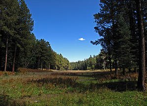
A mid to intermediate level route finding "off-trail" hike to enter and hike within riparian and easy to navigate Merritt Draw at its upper end following the Official Route. Two perennial springs (Whispering Spring and another UN-named Spring) are along this delightful hiking route. Partially closed to vehicle traffic and easy to hike, FR9735P is also part of this loop hike.
WARNING! Hiking and outdoor related sports can be dangerous. Be responsible and prepare for the trip. Study the area you are entering and plan accordingly. Dress for the current and unexpected weather changes. Take plenty of water. Never go alone. Make an itinerary with your plan(s), route(s), destination(s) and expected return time. Give your itinerary to trusted family and/or friends.
Permit $$
None
Directions
Road
High Clearance possible when dry
To hike From the PHOENIX
Take the Beeline Hwy 87 north all the way past Payson, Strawberry, and past the small community of Clints Well; Continue on Hwy 87 past the right turn for signed Blue Ridge Reservoir, continue on Hwy 87 past the signed right turn for Moqui / Blue Ridge Campgrounds, continue on Hwy 87 past the Blue Ridge Ranger Station to the next signed FR right turn onto FR95; Turn Right onto FR95 at way point N34 36.785 W111 11.209 and follow signs for FR95 South, then a major downhill on FR95 to FR95/FR96 intersection after crossing East Clear Creek Bridge; "Stay on" FR95 (a ~right turn SSW) and continue uphill until you reach signed FR139; Turn left onto FR139 (Note: set your odometer to "0") and continue south on FR139 for ~6.6mls to signed FR139C on your left side at waypoint N34 26.535 W111 11.900; Turn Left onto unmaintained, easy to follow gravel FR139C (Note: set your odometer to "0") and continue driving on FR139C for ~.450 mile to waypoint N34 26.513 W111 11.669 (Note: As of this writing, there is a small rock cairn on left side of road designating TH "off trail" Start Location; Park off the right side of this FR139C road);
Please also note: Via either Hwy 260 east/FR300 from Payson "or" from Payson Hwy 87 north/FR300 (at Milepost 281.1 on Hwy 87), you can drive to the SW end of FR139 at its intersection with Rim Road FR300, then drive north up FR139 for ~2.0 miles to intersect FR139C and then make a right turn onto FR139C and follow the directions noted above;
page created by Grasshopper on Oct 06 2011 7:17 pm
 Route Editor

 Overview