username
X
password
register
for free!
help


Umpstead State Park, NC

Guide 1 Triplog  0 Topics
  5 of 5  
Fav
Wish
0
details
drive
no permit
forecast
map
stats
photos
triplog
topics
location
10 1 0
Statistics
tap row or icons for details
Distance One Way 10 miles
Trailhead Elevation 488 feet
 Interest Off-Trail Hiking, Historic & Peak
unreported if dogs are allowed
editedit > ops > dogs to adjust
feature photo
Photos Viewed All MineFollowing
10  2007-07-24 gummo
Author
author avatar Guides 16,843
Routes 17,472
Photos 24
Trips 1 map ( 6 miles )
Age 28 Male Gender
Location HAZ, TrailDEX
Associated Areas
list map done
Central Region
Historical Weather
Trailhead Forecast
Expand Map
Preferred Nov, Apr, Oct, Mar
Sun  5:51am - 6:34pm
0 Route
 
0 Alternative


Named after William B. Umstead, Umpstead State Park is tucked between the growing cities of Raleigh, Cary, Durham and the corporate world of Research Triangle Park is an oasis of tranquility, a peaceful haven--William B. Umstead State Park.


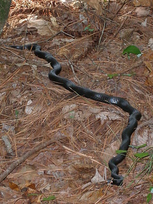
Here, two worlds merge as the sounds of civilization give way to the unhurried rhythm of nature. Highways fade in the distance as trees, flowers, birds and streams form a more natural community. William B. Umstead is a place to escape the pressures of everyday life, a place to picnic in the pines, to wait for a fish to bite, to take a hike or horseback ride on trails through the woods.
remove free decal offer
Divided into two sections, Crabtree Creek and Reedy Creek, this 5,579-acre park is easily accessible from Interstate 40 and US 70. Visit William B. Umstead State Park and enjoy this region of wilderness at the city's doorstep.

2018-07-14 HAZ_Hikebot


    Check out the Triplog.
    Leave No Trace and +Add a Triplog after your hike to support this local community.

    One-Way Notice
    This hike is listed as One-Way.

    When hiking several trails on a single "hike", log it with a generic name that describes the hike. Then link the trails traveled, check out the example.
    WARNING! Hiking and outdoor related sports can be dangerous. Be responsible and prepare for the trip. Study the area you are entering and plan accordingly. Dress for the current and unexpected weather changes. Take plenty of water. Never go alone. Make an itinerary with your plan(s), route(s), destination(s) and expected return time. Give your itinerary to trusted family and/or friends.

     Permit $$
    None


     Directions
    or
     Road
    Paved - Car Okay

    To hike
    It's right next to the Raleigh International Airport. Address is 8801 Glenwood Avenue, Raleigh, NC 27617.

    Office Phone: (919) 571-4170
    page created by gummo on Dec 21 2011 5:40 pm
     90+° 8am - 6pm kills
    helpcorrectionissue

    end of page marker