|
tap row or icons for details
|
| Difficulty |
|
5 of 5 |
| Distance One Way |
|
18.7 miles |
| Trailhead Elevation |
|
10,273 feet |
| Accumulated Gain |
|
4,830 feet |
| Kokopelli Seeds |
|
34.8 |
| Interest Peak | |
| | |
|
|
|
list |
map |
done |
Southwest Region |
| | |
|
| |
|
|
Historical Weather |
| Trailhead Forecast | | |
|
 |
|
|
| Preferred Jul, Aug, Jun, Sep |
|
|
| | |
| |
Named Locations Coordinate Links
| |
|
| help future hikers |
| post a gps route now |
| | |
| |
|
|
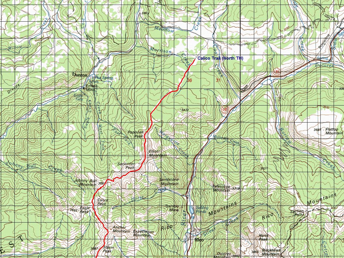
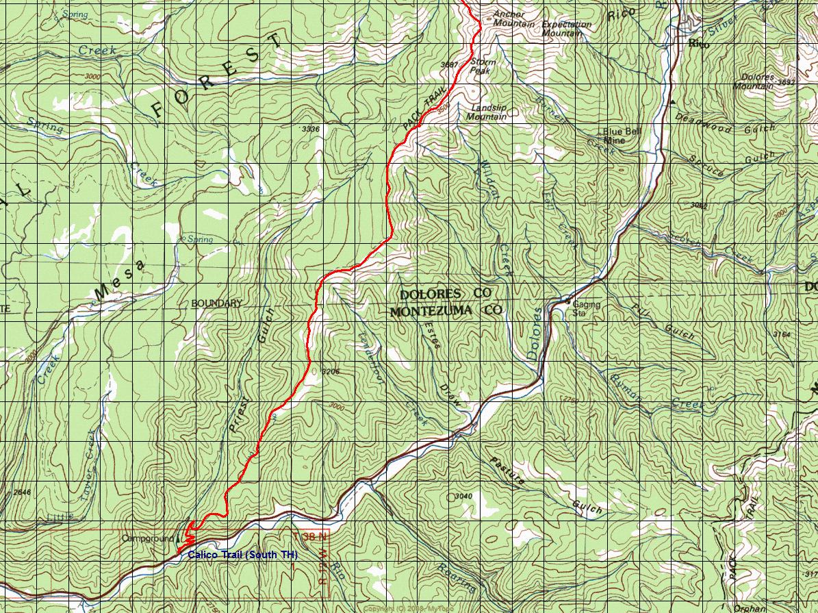
 Overview: Overview: The Calico Trail is comprised of two sections, the Upper and Lower Calico Trails. The lower portion of the trail (TR645) is accessed via the Priest Gulch Trailhead. The most northerly portion (TR208) is referred to as the Upper Calico Trail; this portion of the trail is part of the National Recreation Trail (NRT) system. The Calico Trial is a multi-use single track route. Trail use includes day hiking, backpacking, horseback riding, mountain biking, and dirt bike riding. The trail makes its way over and around several peaks, as well as along fairly long stretches of narrow ridgelines with spectacular sweeping views. Starting elevation is 10,260 (Calico Trailhead). Highest elevation is 12,150 (Sockrider Peak). Ending elevation is 8,050 (Priest Gulch Trailhead). NoteThis is a difficult hike. It would be insane to attempt this entire hike without prior experience hiking. One-Way NoticeThis hike is listed as One-Way. When hiking several trails on a single "hike", log it with a generic name that describes the hike. Then link the trails traveled, check out the example. |
 Route Editor


