This mostly on-trail hike is packed with history, great views, and a modicum of good exercise. Following the route described below will certainly get you LOST as you start at a point near the beginning of the trail by the same name. You may also begin the loop at several other points along the route, but be sure to complete the full circle if you want all of the benefits.
Beginning at the Picketpost Trailhead, you will proceed northerly across US 60 (keep your eyes up and away from that GPS as you carefully cross the highway). Your goal is to reach the intersection of FR357 and the Legends of Superior Trail. From this point, proceed easterly along the LOST trail and parallel to the old railroad line until you reach interpretative sign #10, which explains the Magma RR line's purpose. From here, you can either continue along the LOST using the culvert to cross beneath the highway or head due south directly across US 60 to the intersection with Perlite Road. Follow Perlite Road south to interpretative signs #8 and #7. (A short side excursion east will take you to interpretive sign #6 and the terraced hillside site of an old Mill. After visiting the Mill site, continue south and bushwhack your way east along Queen Creek back to Perlite Road.)
Here we leave the LOST and continue south along Perlite Road, across Queen Creek, where you will soon encounter the Town of Pinal remnants. There isn't much to see today, but imagine the buildings that once stood upon the footings and foundations still visible among the grasses. As you continue past old Pinal, the jeep road begins the first increase in elevation of this hike. At the top of the hill, take the left fork in the road, passing the barricade, and head southeast along the footpath. Soon you will encounter the first of several "digs" that once comprised the Apache Tears Mine. If you're old enough to remember, you may have once long ago come here with your parents to dig for those black glass-like gems hidden amongst the perlite walls of the caves. Then you would have been provided with a tiny bucket and metal scoop for scraping loose those jewels. Though much of the mine is now fenced off, there are still places where you might find a trinket or two.
As you approach the first section of the mine, you begin to view the horseshoe-shaped contours of the trail as it proceeds east, then south, and finally west until it reaches a cattle guard and the long descent down into Arnett Creek. With the historical portion of the hike now behind, you drop along an abandoned jeep trail into the creek and follow its course along and into Telegraph Canyon. If you are not in the mood for some serious bushwhacking that soon follows, I suggest you continue along Arnett Creek until you reach the intersection with Telegraph Canyon Road. Following TCR will reconnect you with the GPS route provided at a point farther along the route.
If you decide to handle Telegraph Canyon, proceed along the wash to a fence, follow the fence to your right (north) until you reach a gate, and proceed through the gate. Soon you will encounter a jungle of vegetation - some friendly, some not - and you will spend a prolonged period hacking your way along as you try to stay in the wash (flowing water in January). At one point, I chose to exit the wash and climb to the south. By contouring on the ridge overlooking the wash, I was able to find an arch and a pleasant alternative to the bushwhacking. Drop back into the wash as you near Telegraph Canyon Road.
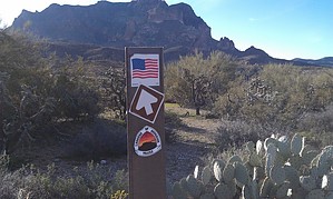
Shortly thereafter, the route will leave the roadway on a horse trail. The trail increases in elevation once again, bringing you to the intersection with the Arizona Trail. From here, is it a pleasant hike back to your vehicle as your course once more heads north through Alamo Canyon.
Gate Policy: If a gate is closed upon arrival, leave it closed after you go through. If it is open, leave it open. Leaving a closed gate open may put cattle in danger. Closing an open gate may cut them off from water. Please be respectful, leave gates as found. The exception is signage on the gate directing you otherwise.
WARNING! Hiking and outdoor related sports can be dangerous. Be responsible and prepare for the trip. Study the area you are entering and plan accordingly. Dress for the current and unexpected weather changes. Take plenty of water. Never go alone. Make an itinerary with your plan(s), route(s), destination(s) and expected return time. Give your itinerary to trusted family and/or friends.
Permit $$
None
Directions
Road
Paved - Car Okay
To hike Take US 60 to the Picketpost Trailhead about 3 miles west of the town of Superior. The trailhead is approximately 1 mile after you leave the highway and follow a graded dirt/asphalt mix road. There are facilities at the trailhead.
 Route Editor

 This mostly on-trail hike is packed with history, great views, and a modicum of good exercise. Following the route described below will certainly get you LOST as you start at a point near the beginning of the trail by the same name. You may also begin the loop at several other points along the route, but be sure to complete the full circle if you want all of the benefits.