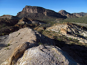
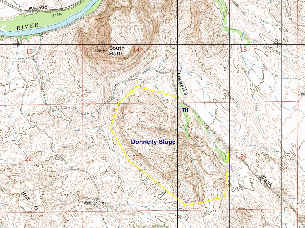
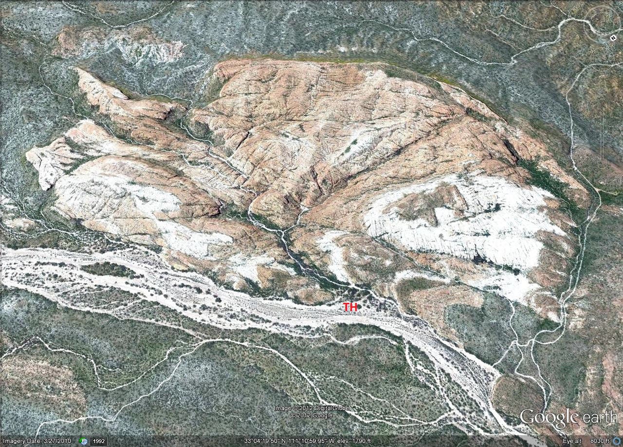
Overview: Unique rock slope with intricate inner canyons sitting in the shadow of South Butte. The outer west edge has a long elevated cliff face overlooking the desert floor towards Florence. Donnelly Slope is a great walk-about destination for random exploring. Very Special!
WARNING! Hiking and outdoor related sports can be dangerous. Be responsible and prepare for the trip. Study the area you are entering and plan accordingly. Dress for the current and unexpected weather changes. Take plenty of water. Never go alone. Make an itinerary with your plan(s), route(s), destination(s) and expected return time. Give your itinerary to trusted family and/or friends.
Permit $$
AZ State Recreational Land Permits
For hiking, driving & sightseeing purposes, you seek a recreational permit.
Under "Recreational Land Use" in the link above.
2022 - $15.00 individual
2022 - $20.00 family limited to two adults and children under the age of 18
Plus $1 processing fee
The permitting process is quick, you will be emailed your permit instantly.
 Route Editor

 Overview: Unique rock slope with intricate inner canyons sitting in the shadow of South Butte. The outer west edge has a long elevated cliff face overlooking the desert floor towards Florence. Donnelly Slope is a great walk-about destination for random exploring. Very Special!