 Route Editor

| Guide | 0 Triplogs | 0 Topics |
details | drive | no permit | forecast | route |
stats |
photos | triplogs | topics | location |
| 47 | 0 | 0 |
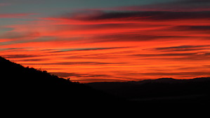
Hing Point in the Park by slegal  The trail starts at its intersection with the Mesa Trail. The trail rises quickly as it heads up the southern slope of Mount Clef Ridge. The trail then turns east and levels out for a short distance before heading up a series of switchbacks. As you head up toward the switchbacks you will be entering an area rich with cactus. The cactus does occasionally break off and lay on the trail. Keep your eyes open and avoid the cactus.
From this high point in the park, you are greeted with excellent views of the Wildwood Mesa to the southwest and the Santa Rosa Valley to the north. The trail continues down the other side of the ridge. less than 50 yards below to high point on the trail there are stands of poison oak. Poison oak may be Wildwood's best example of result global warming. Poison oak has always been abundant down in the canyon, where the creek keeps the plant well hydrated. However, up on the Santa Rosa Trail, poison oak has gone from fairly sparse to quite abundant over the past 10 years. I recollect that since a substantial wet winter in 1998, poison oak got a foothold on the northern slopes of Mount Clef Ridge. Having hiked this trail for over two decades, this is one of the most dramatic changes I've observed. As you descend the trail on the north side of the ridge you wrap around a hillside neighborhood of expensive homes with fantastic views of their own, hidden from view of most areas within the City of Thousand Oaks. You'll head in a northeastern direction for most of the rest of the hike. At a little over 1.3 miles into the hike, you will reach a trail junction. If you go straight you will continue on the Santa Rosa Trail. If you turn right the trail will take you up to the Wildwood Avenue Trailhead. You can get back to the parking area in Wildwood Park by heading downhill on Wildwood Avenue until you get to Big Sky Drive. Take Big Sky Drive west to the end. Big Sky Drive dead-ends at Avenida de Los Arboles, right where the Wildwood Park parking area is. If you stay on the Santa Rosa Trail you will continue heading downhill for a while. As the trail levels out you'll pass an underground spring. The evidence is obvious in that there is a lot of green vegetation here, even during the summer months. There is also a fair amount of poison oak, so keep an eye out for it. After passing the spring the trail opens up. You'll see evidence of ancient lava flows along this section. Just before you reach the end of the trail you'll make a sharp right onto an old dirt road and head up a short but steep hill that will take you back over the ridgeline to the southern slope. The official end of the trail is at the intersection of a trail that runs between two neighborhoods. If you turn right at this intersection you are only a few yards from Camino de Celeste. You can take Camino de Celeste to Wildwood Avenue. If you prefer to avoid pavement on your hike then just turn around and retrace your steps. Check out the Official Route. Leave No Trace and +Add a Triplog after your hike to support this local community. One-Way Notice This hike is listed as One-Way. When hiking several trails on a single "hike", log it with a generic name that describes the hike. Then link the trails traveled, check out the example. | ||||||||||||||||||||||||||||||||||||||||||||||||||||||||||||||||||||||||||||||||||


