Route Editor

| Guide | ♦ | 3 Triplogs | 0 Topics |
details | drive | permit | forecast | route |
stats |
photos | triplogs | topics | location |
| 32 | 3 | 0 |
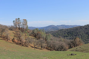
Bay Area Wild by JimmyLyding The starting point is the Park Headquarters at the end of East Dunne Ave., and there are some decent facilities. The park HQ is the old ranch house. One can purchase maps, books, water, Gatorade, snacks, and a few souvenirs after touring the museum. It's more reminiscent of a HQ at a small national park than one at a California state park.
Go right off of the road at campsite #7 (it's very well-marked) onto the Madrone-Soda Springs Trail for a steep descent of 900' in about a mile down into the thickly forested bottom of Soda Springs Canyon. This is a nice spot for a break as there's a babbling brook and a few nice spots to sit. Go left/east on the Mile Trail at the bottom for 1.2 mile as it goes through the dense forest of the canyon bottom. Keep an eye out for poison oak because it's everywhere. The views open up close to China Hole which is the confluence of the East Forks and the Middle Forks of Coyote Creek. China Hole consists of a fairly wide creek with 2 or 3 large pools. This is also a good spot for a break because of the breathtaking views and abundance of water. It's also a good place for a break because this hike gets a lot tougher about a mile later after taking the Creekside Trail to the left/north from China Hole then walking along Poverty Flat Road until turning right onto the Middle Ridge Trail after passing through the Poverty Flat primitive campground. No facilities except for a vault toilet, but it can be reached by car. There is a nice creek going through the canyon there. The Middle Ridge Trail goes 2.3 miles north across the east side of the ridge through some interesting vegetation. A species of manzanita grows to almost 20' tall and ponderosa pines make occasional appearances in the fire-scarred landscape. The Lick Fire of 2007 burned approximately 40,000 acres to some degree, but this area seems to have benefited from it. Much of the understory has been cleared out and some trees are dead, but there's a lot of healthy growth. Middle Ridge Trail has some steep portions that will test one's stamina, but the trail tops off at a saddle on top of the ridge soon enough. There are great views in all directions, and it will be windy at the top of the ridge. The junction with the Fish Trail is only 2.3 miles away from Poverty Flat Road, but it's a world away considering the change from a forest of dense live oaks and riverine trees to the ponderosa pines and valley oaks that dot the ridge tops. Get ready to give a lot of that elevation gain back on the Fish Trail while it heads 1.9 mile west and down into the Little Fork of Coyote Creek before gaining about 700' more AEG over the next 2.5 back to the Manzanita Point Road (the same spot where this hike turns onto the Springs Trail). There is a nice oak and canyon-bottom forest here. Take the Corral Trail from the junction back to the trailhead 0.6 mile away. Check out the Official Route and Triplogs. Leave No Trace and +Add a Triplog after your hike to support this local community. | |||||||||||||||||||||||||||||||||||||||||||||||||||||||||||||||||||||||||||||||||||||