|
Golden Eagle Loop - Fountain Hills
|
11.1 mi
1,709 ft |
 |
|
Golden Eagle Super Lasso
|
16.72 mi
3,214 ft |
|
|
Golden Eagle Loop - Fountain Hills
|
11.61 mi
1,789 ft |
|
|
Thompson Peak Trail - MSP
|
14.34 mi
4,513 ft |
|
|
Golden Eagle Loop - Fountain Hills
|
11.46 mi
1,688 ft |
|
|
Bell Pass from Dixie Mine
|
9.31 mi
1,507 ft |
|
| Thompson Peak
|
13.19 mi
3,837 ft |
|
|
|
Bell Pass from Dixie Mine
|
9.35 mi
1,429 ft |
|
|
Golden Eagle Loop - Fountain Hills
|
11.48 mi
1,627 ft |
|
|
Golden Eagle Loop - Fountain Hills
|
11.72 mi
1,666 ft |
|
|
Bell Pass from Dixie Mine
|
9.35 mi
1,418 ft |
|
|
Bell Pass from Dixie Mine
|
9.22 mi
1,415 ft |
|
|
Bell Pass from Dixie Mine
|
9.25 mi
1,464 ft |
|
|
Bell Pass from Dixie Mine
|
9.29 mi
1,427 ft |
|
|
Bell Pass from Dixie Mine
|
9.24 mi
1,564 ft |
|
|
Bell Pass from Dixie Mine
|
9.29 mi
1,458 ft |
|
|
Bell Pass from Dixie Mine
|
9.24 mi
1,466 ft |
|
|
Dixie Mine - Windgate Lasso Loop
|
16.18 mi
3,176 ft |
|
|
Thompson Peak Loop
|
13.28 mi
2,684 ft |
|
|
Adero Super Loop
|
19.62 mi
3,264 ft |
|
|
Golden Eagle Loop - Fountain Hills
|
11.42 mi
1,682 ft |
|
|
Bell Pass from Adero Canyon
|
14.08 mi
2,572 ft |
|
|
Bell Pass from Dixie Mine
|
10.38 mi
2,214 ft |
|
|
Bell Pass from Dixie Mine
|
9.22 mi
1,568 ft |
|
|
Bell Pass from Dixie Mine
|
9.21 mi
1,637 ft |
|
|
Bell Pass from Dixie Mine
|
9.47 mi
1,428 ft |
|
|
Bell Pass from Dixie Mine
|
9.4 mi
1,445 ft |
|
| Thompson Peak Rd - MSP
|
11.91 mi
3,594 ft |
|
|
|
Bell Pass from Dixie Mine
|
9.43 mi
1,450 ft |
|
|
Golden Eagle Loop - Fountain Hills
|
11.67 mi
1,760 ft |
|
|
Bell Pass from Dixie Mine
|
9.29 mi
1,495 ft |
|
|
Bell Pass from Dixie Mine
|
9.4 mi
1,440 ft |
|
|
Bell Pass from Dixie Mine
|
9.38 mi
1,450 ft |
|
|
Bell Pass from Dixie Mine
|
9.41 mi
1,451 ft |
|
|
Bell Pass from Dixie Mine
|
9.36 mi
1,406 ft |
|
|
Bell Pass from Dixie Mine
|
9.44 mi
1,449 ft |
|
|
Golden Eagle Loop - Fountain Hills
|
11.63 mi
1,757 ft |
|
|
Bell Pass from Dixie Mine
|
9.42 mi
1,418 ft |
|
|
Bell Pass from Dixie Mine
|
9.37 mi
1,461 ft |
|
|
Bell Pass from Dixie Mine
|
9.25 mi
1,497 ft |
|
|
Bell Pass from Dixie Mine
|
9.36 mi
1,469 ft |
|
|
Bell Pass from Dixie Mine
|
9.4 mi
1,469 ft |
|
|
Bell Pass from Dixie Mine
|
9.3 mi
1,421 ft |
|
|
Bell Pass from Dixie Mine
|
9.4 mi
1,496 ft |
|
|
Golden Eagle Loop - Fountain Hills
|
11.65 mi
1,703 ft |
|
|
Thompson Peak Rd - MSP
|
15.27 mi
3,999 ft |
|
|
Golden Eagle Loop - Fountain Hills
|
11.48 mi
1,785 ft |
|
|
Dixie Mine Super Loop
|
18.27 mi
3,579 ft |
|
|
Adero Super Loop via 104th St
|
22.44 mi
4,328 ft |
|
|
Adero Super Loop
|
20.24 mi
3,661 ft |
|
| Golden Eagle Loop - Fountain Hills
|
10.45 mi
1,473 ft |
|
|
|
Golden Eagle Loop - Fountain Hills
|
10.71 mi
1,533 ft |
|
|
Dixie Mine Crazy 8 Loop
|
18.49 mi
3,224 ft |
|
|
Bell Pass from Dixie Mine
|
9.47 mi
1,466 ft |
|
|
Bell Pass from Dixie Mine
|
9.46 mi
1,399 ft |
|
|
Bell Pass from Dixie Mine
|
9.46 mi
1,439 ft |
|
|
Bell Pass from Dixie Mine
|
9.27 mi
1,529 ft |
|
|
Bell Pass from Dixie Mine
|
9.33 mi
1,488 ft |
|
|
Bell Pass from Dixie Mine
|
9.4 mi
1,488 ft |
|
|
Bell Pass from Dixie Mine
|
9.4 mi
1,488 ft |
|
|
Bell Pass from Dixie Mine
|
9.4 mi
1,496 ft |
|
|
Bell Pass from Dixie Mine
|
9.38 mi
1,496 ft |
|
|
Bell Pass from Dixie Mine
|
9.4 mi
1,580 ft |
|
|
Bell Pass from Dixie Mine
|
9.4 mi
1,580 ft |
|
|
Bell Pass from Dixie Mine
|
9.42 mi
1,653 ft |
|
|
Bell Pass from Dixie Mine
|
9.41 mi
1,632 ft |
|
|
Bell Pass from Dixie Mine
|
9.4 mi
1,565 ft |
|
|
Bell Pass from Dixie Mine
|
9.25 mi
1,655 ft |
|
|
Bell Pass from Dixie Mine
|
9.22 mi
1,655 ft |
|
|
Bell Pass from Dixie Mine
|
9.42 mi
1,639 ft |
|
|
Bell Pass from Dixie Mine
|
9.22 mi
1,655 ft |
|
| Southern McDowell loop
|
19.63 mi
3,347 ft |
|
|
|
Dixie Mine Lasso Loop
|
11.46 mi
1,881 ft |
|
|
Bell Pass from Dixie Mine
|
9.37 mi
1,655 ft |
|
|
Bell Pass from Dixie Mine
|
9.46 mi
1,655 ft |
|
|
Bell Pass from Dixie Mine
|
9.45 mi
1,655 ft |
|
|
Dixie Mine Lasso Loop
|
11.61 mi
1,881 ft |
|
|
Dixie Mine Super Loop
|
18.06 mi
3,818 ft |
|
|
Adero Super Loop
|
19.93 mi
4,069 ft |
|
|
Adero Super Loop
|
20.24 mi
4,083 ft |
|
|
Toms Thumb from Dixie Mine TH
|
14.75 mi
3,136 ft |
|
| Bell Pass from Dixie Mine
|
9.08 mi
1,422 ft |
|
|
| Bell Pass from Dixie Mine
|
9.12 mi
1,403 ft |
|
|
| Bell Pass from Dixie Mine
|
9.08 mi
1,422 ft |
|
|
| Bell Pass from Dixie Mine
|
9.08 mi
1,398 ft |
|
|
| Bell Pass from Dixie Mine
|
9.11 mi
1,364 ft |
|
|
| Bell Pass from Dixie Mine
|
9.04 mi
1,379 ft |
|
|
| Bell Pass from Dixie Mine
|
9.52 mi
1,437 ft |
|
|
| Bell Pass from Dixie Mine
|
9.06 mi
1,388 ft |
|
|
| Dixie Mine Lasso Loop
|
11.16 mi
1,597 ft |
|
|
| Bell Pass from Dixie Mine
|
9.04 mi
1,407 ft |
|
|
| Bell Pass from Dixie Mine
|
9.06 mi
1,359 ft |
|
|
| Bell Pass from Dixie Mine
|
9.05 mi
1,416 ft |
|
|
| Bell Pass from Dixie Mine
|
9.06 mi
1,390 ft |
|
|
| Bell Pass from Dixie Mine
|
9.12 mi
1,429 ft |
|
|
| Bell Pass from Dixie Mine
|
9.05 mi
1,416 ft |
|
|
| Bell Pass from Dixie Mine
|
9.08 mi
1,420 ft |
|
|
| Bell Pass from Dixie Mine
|
9.08 mi
1,434 ft |
|
|
| Adero Canyon TH to Bell Pass
|
13.61 mi
2,471 ft |
|
|
| Peak 3515 from Golden Eagle TH
|
9.42 mi
1,775 ft |
|
|
|
Thompson Peak
|
14.01 mi
3,735 ft |
|
| Adero Super Loop
|
18.75 mi
3,333 ft |
|
|
| Adero Canyon 2 Bell Pass
|
13.54 mi
2,453 ft |
|
|
|
Sonoran Loop
|
19.33 mi
3,242 ft |
|
|
Thompson Peak from 104th St
|
13.2 mi
3,629 ft |
|
| Bell Pass from Dixie Mine
|
9.03 mi
1,408 ft |
|
|
| Bell Pass from Dixie Mine
|
9.05 mi
1,420 ft |
|
|
| Bell Pass from Dixie Mine
|
8.99 mi
1,385 ft |
|
|
| Bell Pass from Dixie Mine
|
9.07 mi
1,408 ft |
|
|
| Bell Pass from Dixie Mine
|
9.29 mi
1,418 ft |
|
|
| Bell Pass from Dixie Mine
|
9.02 mi
1,387 ft |
|
|
| Bell Pass from Dixie Mine
|
9.03 mi
1,442 ft |
|
|
| Bell Pass from Dixie Mine
|
9.34 mi
1,463 ft |
|
|
| Bell Pass from Dixie Mine
|
9.04 mi
1,406 ft |
|
|
| Bell Pass from Dixie Mine
|
9.05 mi
1,446 ft |
|
|
| Dixie Mine Lasso Loop
|
11.46 mi
1,661 ft |
|
|
|
TransMSP Xpogo
|
16.33 mi
2,928 ft |
|
| Dixie Prospector Loop
|
10.38 mi
1,374 ft |
|
|
| Bell Pass from Dixie Mine
|
8.99 mi
1,468 ft |
|
|
|
Thompson Peak from Gateway
|
14.51 mi
3,860 ft |
|
| Lost Dog Sunrise Paradise Loop
|
20.93 mi
5,502 ft |
|
|
| Dixie Mine-Loop
|
10.26 mi
1,357 ft |
|
|
| Thompson Peak from Dixie Mine TH
|
13.47 mi
3,790 ft |
|
|
| Golden Eagle Loop - Fountain Hills
|
11.47 mi
1,787 ft |
|
|
| Thompson Peak from 104th St TH
|
13.11 mi
3,764 ft |
|
|
| Thompson Peak-East End via 104th St
|
20.37 mi
5,398 ft |
|
|
| McDowell Mountain Loop
|
33.05 mi
6,356 ft |
|
|
| Thompson Peak from Dixie Mine TH
|
13.23 mi
3,763 ft |
|
|
| Bell Pass Thompson Peak Windate Loop
|
16.97 mi
4,324 ft |
|
|
| Thompson Peak via Gateway TH
|
12.67 mi
3,717 ft |
|
|
| Thompson Peak from Gateway Trailhead
|
13.13 mi
3,790 ft |
|
|
| McDowell Loop
|
18.84 mi
4,169 ft |
|
|
| Thompson Peak from Dixie Mine TH
|
13.54 mi
3,880 ft |
|
|
| Dixie Mine Trail - MMRP
|
11.36 mi
1,781 ft |
|
|
| Tom's Thumb Loop off Windgate Pas...
|
32.4 mi
4,736 ft |
|
|
| Thompson via Bell Pass
|
13.19 mi
3,787 ft |
|
|
| Bell Pass Trail - MSP
|
5.62 mi
2,087 ft |
|
|
| Thompson Peak from Dixie Mine TH
|
10.4 mi
2,351 ft |
|
|
| McDowell Meander
|
19.89 mi
5,720 ft |
|
|
| Golden Eagle Loop with Bell Pass
|
11.69 mi
1,727 ft |
|
|
| Golden Eagle Loop - Fountain Hills
|
10.15 mi
1,375 ft |
|
|
| Thompson Peak Coachwhip Loop - MSP
|
13.57 mi
2,762 ft |
|
|
| Thompson Peak to Tom's Thumb TH
|
11.39 mi
3,576 ft |
|
|
| SuperLoop Windgate Bell Pass - MSP
|
9.51 mi
2,139 ft |
|
|
| Tom's Thumb Trail - MSP
|
17.47 mi
5,012 ft |
|
|
| Tom's Thumb Trail - MSP
|
16.06 mi
3,713 ft |
|
|
| Golden Eagle Loop - Fountain Hills
|
11.15 mi
1,546 ft |
|
|
| Thompson Peak from Dixie Mine TH
|
14.35 mi
3,748 ft |
|
|
 Route Editor

 Overview: prospector trail goes from bell pass trail to thompson peak road a connector trail offereing access from the mcdowell sonoran preserve to thompson peak or to mcdowell mountain regional park
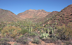


