Route Editor

| Guide | ♦ | 2 Triplogs | 0 Topics |
details | drive | no permit | forecast | route |
stats |
photos | triplogs | topics | location |
| 9 | 2 | 0 |
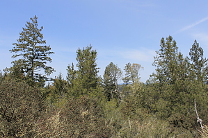
Santa Cruz Redwoods by JimmyLyding  Perhaps the most important thing about this park is its historical significance in terms of preserving redwoods in the Santa Cruz Mountains. A young, struggling photographer named Andrew P. Hill was photographing old growth redwoods here when the owner of the resort that owned the area at the time demanded he either pay for taking pictures or hand over the negatives. Hill was outraged, and promptly founded the Sempervirens Club (now the Sempervirens Fund) in 1900. The Sempervirens Club attracted the personal support of numerous important and influential people in the region, and eventually spearheaded the 1902 creation of California Redwood Park which is now known as Big Basin Redwoods State Park. The preservation of the Santa Cruz Mountains' redwoods has continued apace ever since with a lot of help from the Sempervirens Fund.
This hike starts at the main parking lot near a gift shop that looks like a visitors center. This is the Mountain Parks Foundation Store, and the official visitors center is about 100 yards to the south. Head that direction and get on the Redwood Grove Loop which is a short 1/2 mile loop that's handicapped accessible. Taking either fork will lead you to the impressive John C. Fremont Tree which is as impressive as any tree at Muir Woods or Big Basin. You will most likely see lots of people here for obvious reasons, not least among them this park's proximity to Santa Cruz. There is a his/her vault toilet here, and the Pipeline trail heads south-southwest. Take that and either stay on this glorified road or the River Trail which soon branches off to the right and parallels your route a little closer to the San Lorenzo River. Your route goes under the bridge for the little railroad that takes tourists for a short adventure that would be of little interest to anyone reading this. The vegetation here has changed from deep redwood forest to riparian as the river becomes more apparent. Sycamores, maples, and thick riverine vegetation line the San Lorenzo River until you turn left (east) onto the Eagle Creek Trail about 1/2 mile from the parking lot. Eagle Creek Trail heads uphill along its namesake creek first through second-growth redwoods then dense chaparral that reaches 15-feet-tall. The vegetation begins to make a dramatic change to the chaparral that is unique to this area. The loose, sandy soil doesn't hold a lot of water so a collection of mismatched plants, many of them unique to the area, but does have rare stands of ponderosa pine. The Eagle Creek Trail winds uphill about 400 vertical feet from the river to its junction with the Pine Trail (1.5 overall miles from the trail head) where you want to turn right/south on to the Pine Trail. From here it is another 1/2 mile and 300 vertical feet to a cool lookout tower. The lookout is a 30' x 30' large concrete pad about 15' above the summit next to a very convoluted ponderosa. The hike gets noticeably more serious here as both the Pine Trail and Powder Mill fireroad head south from the summit to meet after about 1/2 mile. Continue south and downhill from here along the Buckeye trail as it switchbacks down to the San Lorenzo River about another 1/2 mile away. The real fun begins here. The Buckeye trail makes its way down to the river, and gets lost in a mess of riparian vegetation. I think we missed the true crossing, but you're going to get wet either way. There is simply no way to get across the river without wading. It was only about 24" deep during the first week of April 2012, and probably ranges between 12" and 36". Somehow find a way across (this is a great hike to bring Tevas, BTW), and rejoin the Buckeye trail. Buckeye curls around the ridge that defines this u-bend in the San Lorenzo River before crossing the river again to join the Big Rock Hole trail. I have no idea what the Big Rock Hole is, but its namesake trail heads north and uphill for a sharp gain of over 500' over a mile through second-growth redwood, tanoak, and California bay. The trail levels out before reaching its junction with the Ridge fire road. Continue straight along the Rincon fire road (which has been paralleling the Big Rock Hoe trail), and perhaps enjoy more of the redwood grove before returning to you car just a few hundred yards beyond. Check out the Official Route and Triplogs. Leave No Trace and +Add a Triplog after your hike to support this local community. | |||||||||||||||||||||||||||||||||||||||||||||||||||||||||||||||||||||||||||||||||||||