 Route Editor

| Guide | ♦ | 6 Triplogs | 0 Topics |
details | drive | no permit | forecast | 🔥 route |
stats |
photos | triplogs | topics | location |
| 14 | 6 | 0 |
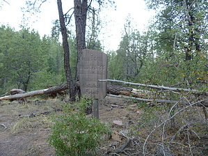
Flat this isn't by sventre   Note: Stats are for actual #186 one-way segment only. Note: Stats are for actual #186 one-way segment only.This hike begins with a strenuous climb from the Bear Flat Trailhead. Once atop the ridge, it is a moderate roller coaster (mostly flat)all the way out to Horse Pasture Tank. Fate, in the form of the Forest Service, dictated that I make this hike today. Concerned with the extreme dry forest, the Service had closed practically all of the Rim Country trails north of SR 260; but, fortunately, they also canceled the 2012 closure order for FR405 that had been occasioned by a "bear attack" (what constitutes a threat I will leave to your judgment). The hike: I began before sunrise to avoid the quick temperature increases that occur each morning in June. The TH (Bear Flat #178) is easy enough to find even in the dark, but once you have crossed the Tonto Creek (almost immediately as you begin), you will encounter the marker for trail #178. What was confusing for me was that the directional arrow on the sign points straight ahead, but with the minimal lighting available, I could only discern a game trail to the right. For the next 45 minutes, I zig-zagged across the slippery slopes from one game trail to another, thinking these were switchbacks to reach the top. Pine needles covered much of this "trail," which altered from about 12 to 3 inches wide as I made my way up and then down again, hopelessly trying to find the real trail. What I discovered on the return trip was that I should have begun the hike by starting with an immediate left turn after crossing Tonto Creek and following the fence line of the private property. The GPS route accompanying this description leaves out the "fun stuff,"; but if you're into nearly vertical ascents with no firm footing, clinging to every sapling you can find to avoid sliding back down to the campground and crawling over deadfall, then turn right at the trail marker.
Check out the Official Route and Triplogs. Leave No Trace and +Add a Triplog after your hike to support this local community. One-Way Notice This hike is listed as One-Way. When hiking several trails on a single "hike", log it with a generic name that describes the hike. Then link the trails traveled, check out the example. | |||||||||||||||||||||||||||||||||||||||||||||||||||||||||||||||||||||||||||||||||||||||||||||||||||||||||


