| Guide | ♦ | 1 Triplog | 0 Topics |
details | drive | permit | forecast | route |
stats |
photos | triplog | topics | location |
| 7 | 1 | 0 |
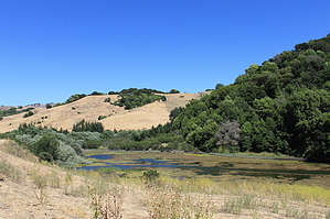
UP and Down by JimmyLyding The centerpiece of this hike is Upper San Leandro Reservoir though the route does not circumnavigate it. The reservoir was formed in 1926 on San Leandro Creek. San Leandro Creek is notable because it is one of the few creeks feeding San Francisco Bay that formerly had runs of Chinook salmon, coho salmon, and steelhead trout. This is also the site of the world's first rainbow trout hatchery, and indeed also harbored the rainbow trout that would become the Latin namesake of the species.
Sign in at the trail register (i.e. writing down your EBMUD pass number and license plate), and head left/south towards the reservoir. There's a picnic bench immediately on your left, and a trail junction about 1/4 mile ahead. Go left/east if you want to do the big up and big down first, or right if you want to do the segment with many small ups-and-downs. My description goes left. This portion travels through a nice grove of tall knobcone pine before crossing a bridge over Moraga Creek. Go right on the south side of the bridge and continue along the reservoir past a working ranch before turning left at the junction with the Rocky Ridge Trail that heads uphill. The route heads away from the reservoir, and rapidly gains elevation. You reach the top of a ridge with the reservoir behind you and a nice-looking neighborhood in front of you to the east. Turn right/south and walk by a house that looks like it's been under construction for the past 30 years, and hit the big uphill climb. This segment is underneath tall tanoak and live oak trees with heavy undergrowth on both sides. This area has a lot of poison oak so be careful. The route hits a junction with the fire road that travels to the top of the mountain, but taking it is illegal according to a prominent sign. The Rocky Ridge Trail then heads straight downhill. The trail here is very steep, but eventually crosses a meadow that was full of cattle on my initial visit (including an intact bull hanging out right next to the trail). There is actually a hiker's gate, but I climbed up and over the cattle gate in my haste. Go right (there's another trailhead here) towards the reservoir on the Kings Canyon Loop trail, and begin to experience the ups-and-downs that you'll enjoy until you approach the junction with the Rocky Ridge trail. There are occasional views of the reservoir through the dense cover of live oak and chaparral, but at this point your focus is on going up and then going down and repeating seemingly ad nauseum. This is more of a training hike than a destination, but well worth for folks in the East Bay. Gate Policy: If a gate is closed upon arrival, leave it closed after you go through. If it is open, leave it open. Leaving a closed gate open may put cattle in danger. Closing an open gate may cut them off from water. Please be respectful, leave gates as found. The exception is signage on the gate directing you otherwise. Check out the Official Route and Triplog. Leave No Trace and +Add a Triplog after your hike to support this local community. | ||||||||||||||||||||||||||||||||||||||||||||||||||||||||||||||||||||||||||||||||||||||
 Route Editor


