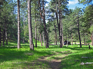
username
X
password
register
for free!
help
  This is likely a great time to hike this trail!  Check out "Preferred" months below, keep in mind this is an estimate.
  🔥

Houston Bros Tr Loop via U-Bar Tr-FR139G, AZ

Guide 7 Triplogs  1 Topic
  3.5 of 5  
Fav
Wish
1
details
drive
no permit
forecast
🔥
route  
stats
photos
triplogs
topic
location
76 7 1
Statistics
tap row or icons for details
Difficulty 1.5 of 5
Route Finding 2 of 5
Distance Loop 3.5 miles
Trailhead Elevation 7,296 feet
Elevation Gain -292 feet
Accumulated Gain 335 feet
Avg Time Round Trip 2.1
Kokopelli Seeds 5.18
 Interest Historic & Seasonal Creek
unreported if dogs are allowed
editedit > ops > dogs to adjust
feature photo
Photos Viewed All MineFollowing
Will recalculate on button tap!
5  2022-07-08
McFarland Spring - Mogollon Rim
ALMAL
20  2021-05-28
Cabin Loop - Mogollon Rim
ddgrunning
20  2019-06-13 Grasshopper
15  2015-07-09
Bear Canyon - Houston Draw Loop
The_Eagle
13  2012-07-14 Grasshopper
10  2012-07-14 Oregon_Hiker
18  2009-06-28 Grasshopper
Author
author avatar Guides 16,843
Routes 17,472
Photos 24
Trips 1 map ( 6 miles )
Age 28 Male Gender
Location HAZ, TrailDEX
Associated Areas
list map done
Payson Region
Historical Weather
Trailhead Forecast
Radar Map
Expand Map
Preferred May, Oct, Sep, Apr → 7 AM
Sun  6:01am - 6:46pm
Official Route & 2 Rts
 
3 Alternative
 
Historic Fire Perimetersacres
🔥 2019 Hart Fire5k
🔥 2016 Pinchot Fire3.9k
🔥 2015 General Fire2.7k
🔥 2009 Tucker Fire2.6k
🔥 View (All) - over Official Route 🔥


remove free decal offer

  Likely In-Season!
Guide Needed
Publish Full Detail Guide


Use +Add above to share photos and triplogs
Overview
Starting from FR139G/FR9738N, the "back way" loop hiking route to access historic and perennial Aspen Spring/Cabin complex, then connect to north Houston Brothers TR#18 to perennial Pinchot Spring to historic Pinchot Cabin; From Pinchot Cabin connect with U-Bar TR#28 to less vehicle traveled FR139G South to end at Park/TH Start;


    Check out the Official Route and Triplogs.
    Leave No Trace and +Add a Triplog after your hike to support this local community.
    WARNING! Hiking and outdoor related sports can be dangerous. Be responsible and prepare for the trip. Study the area you are entering and plan accordingly. Dress for the current and unexpected weather changes. Take plenty of water. Never go alone. Make an itinerary with your plan(s), route(s), destination(s) and expected return time. Give your itinerary to trusted family and/or friends.

     Permit $$
    None


     Directions
    or
     Road
    High Clearance possible when dry

    To hike
    From the intersection of FR139/FR139G: Drive FR139G for .50mls to the "closed to vehicle traffic" but signed FR9738N (at 34.4921 -111.18811); Park here off FR139G and continue to hike down FR9738N; Please also see posted 7-14-12 "FR139G Driving Route to Park/TH Start";
    page created by Grasshopper on Jul 17 2012 10:09 pm
     90+° 8am - 6pm kills
    helpcorrectionissue

    end of page marker