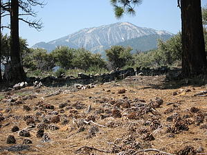
The Nevada Conservation Corps in a joint effort with the U.S. Forest Service completed the connecting trail on this hike in about two months. It makes for a great intermediate trail for high altitude conditioning. Views of Mt Rose and Slide Mountain are in sight and provide motivation.
Whites Creek, Thomas Creek and The Dry Pond Trail make up the route. The hike is about the same difficulty and can be done in either direction. This description is from a clockwise perspective.
Whites Creek Trailhead has ample parking and facilities. The hike starts at the gated fire road. There is plenty of shade here from the ancient pines towering around you. In a short distance Whites Creek becomes audible and soon you are alongside. The creek runs especially strong in the spring but generally has water in it year round. The old fire road continues up hill with the option of a single track trail running along side. The fire road gradually fades into a trail. This is also a mountain bike trail so heads up and keep that I-Pod at a reasonable level so you can hear them. At 1.38 miles and about 322 ft elevation gain you will come to a signed intersection. Turn north headed for Dry Pond. The trail is single track from this point on. First business now is to cross Whites Creek which most times of the year can easily be accomplished rock hopping. The forest has been thinned out offering great views deep into the forest and beyond but still plenty of shade. The trail makes a long sweeping grade and then a series of steeper switchbacks before arriving at Dry Pond. After 2.19 miles and 619 ft elevation gain you arrive at Dry Pond which is believed to be a tarn. Now days it appears to be meadow except for those very wet years when there might be some standing water. Take a break and enjoy the views, 360 degrees. Then continue to the north where the descent begins. The first leg is a long sweeping descent followed by several switchbacks which bring you to a signed intersection for the Thomas Creek Trail. This is at 3.44 miles. Thomas Creek is now audible and it also flows year round. Take The Thomas Creek trail to the east as it meanders through the forest now made up of more aspen than pine. The trail finally crosses Thomas Creek and a short while later arrives at the Thomas Creek Trailhead which also has facilities and ample parking. A short walk down Timberline Drive will get you back to the Whites Creek Trailhead.
Gate Policy: If a gate is closed upon arrival, leave it closed after you go through. If it is open, leave it open. Leaving a closed gate open may put cattle in danger. Closing an open gate may cut them off from water. Please be respectful, leave gates as found. The exception is signage on the gate directing you otherwise.
WARNING! Hiking and outdoor related sports can be dangerous. Be responsible and prepare for the trip. Study the area you are entering and plan accordingly. Dress for the current and unexpected weather changes. Take plenty of water. Never go alone. Make an itinerary with your plan(s), route(s), destination(s) and expected return time. Give your itinerary to trusted family and/or friends.
Permit $$
None
Directions
Road
FR / Dirt Road / Gravel - Car Okay
To hike Directions: From Reno, take U.S. 395 south to the Mount Rose Highway, aka Nevada 431. After 5 miles take a right on Timberline Drive. About 1/2 mile thru a residential area, the unmarked forest road for the Whites Creek Trailhead is on the left.
 Route Editor