username
X
password
register
for free!
help
  This is likely a great time to hike this trail!  Check out "Preferred" months below, keep in mind this is an estimate. 
 

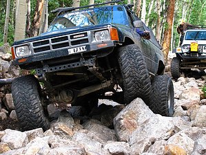
Iron Chest 4X4 Trail, CO

Guide 1 Triplog  0 Topics
  0 of 5  
Fav
Wish
0
details
drive
no permit
forecast
route  
stats
photos
triplog
topics
location
173 1 0
HAZ reminds you to respect the ruins. Please read the Archaeological Resources Protection Act of 1979 & Ruins Etiquette
Statistics
tap row or icons for details
Distance One Way 2.7 miles
Trailhead Elevation 10,065 feet
 Interest Off-Trail Hiking, Ruins, Historic, Seasonal Creek, Perennial Creek & Peak
feature photo
Photos Viewed All MineFollowing
173  2011-08-06 TM1ssKDMac
Author
author avatar Guides 16,843
Routes 17,472
Photos 24
Trips 1 map ( 6 miles )
Age 28 Male Gender
Location HAZ, TrailDEX
Historical Weather
Trailhead Forecast
Radar Map
Expand Map
Preferred Jul, Aug, Jun, Sep
Sun  5:39am - 6:28pm
Official Route
 
0 Alternative


remove free decal offer

  Likely In-Season! 
Guide Needed
Publish Full Detail Guide


Use +Add above to share photos and triplogs
Overview: Iron Chest 4X4 Trail is an extremely rough trail that will take you from St. Elmo to the Iron Chest Mine.


    Check out the Official Route and Triplog.
    Leave No Trace and +Add a Triplog after your 4x4 trip to support this local community.
    WARNING! Hiking and outdoor related sports can be dangerous. Be responsible and prepare for the trip. Study the area you are entering and plan accordingly. Dress for the current and unexpected weather changes. Take plenty of water. Never go alone. Make an itinerary with your plan(s), route(s), destination(s) and expected return time. Give your itinerary to trusted family and/or friends.

     Permit $$
    no fees or permits reported

    if incorrect tell us about it


     Directions
    or
     Road
    Strictly 4x4

    To 4x4 trip
    From Colorado Springs on I-25 take take Hwy 24 west towards Manitou Springs and Woodland Park. Continue for 90 miles to the junction of HWY 24 and HWY 285 just south of Buena Vista. Turn south on HWY 285 towards Salida and continue for 5.6 miles to county road 162 (Chalk Creek Drive). Turn west on Chalk Creek Drive and continue for 15.7 miles towards Mount Princeton Hot Springs and St. Elmo to the start of the Grizzly lake 4X4 Trail just up the hill from St. Elmo at (38.702459 -106.346272).
    page created by TM1ssKDMac on Jul 26 2012 9:37 am
     90+° 8am - 6pm kills
    helpcorrectionissue

    end of page marker