Route Editor

| Guide | ♦ | 8 Triplogs | 0 Topics |
details | drive | no permit | forecast | 🔥 route |
stats |
photos | triplogs | topics | location |
| 68 | 8 | 0 |
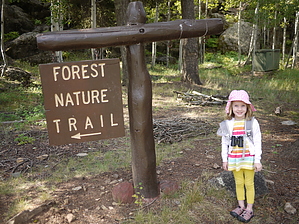
Little loop by a Big Lake by Crzy4AZ  The name "Big Lake" dates back to the early 1900s when this area was a shallow wet meadow/bog where the wild game would roam and take refuge. Over three summers from 1935-37, the Civilian Conservation Corps built a dam and spillways, turning Big Lake into a larger, stocked fishing lake. It spans 450 acres with an average depth of 16 feet, and fish species include Rainbow, Apache trout, Brook & Cutthroat. The Big Lake Nature Visitor Center is a nice place to stop and stretch your legs before a day of fishing or boating. There are several picnic tables under the shady cover of aspen and ponderosa pine, but no water or bathrooms (there are several down by the marina). The name "Big Lake" dates back to the early 1900s when this area was a shallow wet meadow/bog where the wild game would roam and take refuge. Over three summers from 1935-37, the Civilian Conservation Corps built a dam and spillways, turning Big Lake into a larger, stocked fishing lake. It spans 450 acres with an average depth of 16 feet, and fish species include Rainbow, Apache trout, Brook & Cutthroat. The Big Lake Nature Visitor Center is a nice place to stop and stretch your legs before a day of fishing or boating. There are several picnic tables under the shady cover of aspen and ponderosa pine, but no water or bathrooms (there are several down by the marina).The Nature Trail has seventeen markers on the short loop, and copies of the guidebook can be found at the sign-in book or Visitor Center. The trail wraps clockwise back in an easy half-mile loop with one small stretch of elevation gain at the start. From the trailhead at the picnic area, you climb gently to a flat area near Rainbow Campground with Big Lake to your back. You will turn west at marker #4 and follow the path back into the forest. The last two markers will lead you back down rocky steps to the Visitor's Center. This trail is perfect for small kids to hike independently for a short distance with a short attention span.
#1: Metamorphic rock with lichen. #2: Gooseberry and use by Hopi for stomach ache. #3: Overlook on the edge of 10,000 acres of open grassland to the North. The forest edge is behind you and only on north-facing slopes of knolls. #4: Mt. Baldy in the distance. #5: Rangeland and management strategy by ranchers with cattle and sheep underpaid permits from Apache-Sitgreaves national Forest BLM #6: Aspen leaves and bark. #7 Blue spruce and how to tell the difference between evergreens (pines vs. spruces vs. firs vs. Douglas-fir) by looking at needles, cone scales, and pine cones. #8: tree measuring for timber sales. #9: Southwestern white pine compared to Ponderosa pine. #10: Douglas fir and Ponderosa pine comparison. #11: Grocery Store - area around the tree for squirrel. #12: Common Juniper. #13: Rotting Logs home for insects and fungi. #14: Witches Broom - parasite fungus on Douglas-fir tree. #15: Fire scar at the base of the tree. #16: Common chokecherry - sacred plant to Navajos. #17: Red raspberry and Baneberry - the juice of baneberry fruit to poison arrows. More info: * Springerville Ranger District of Apache-Sitgreaves National Forest 928 333 6200. * www.biglakeaz.com * The Civilian Conservation Corps In Arizona's Rim Country: Working In The Woods. R Moore. 2006. ISBN#978-0-87417-677-3 Check out the Official Route and Triplogs. Leave No Trace and +Add a Triplog after your hike to support this local community. | |||||||||||||||||||||||||||||||||||||||||||||||||||||||||||||||||||||||||||||||||||||||||||