Route Editor

| Guide | ♦ | 1 Triplog | 0 Topics |
details | drive | no permit | forecast | route |
stats |
photos | triplog | topics | location |
| 10 | 1 | 0 |
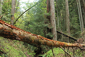
Deep Forest Hike Near Santa Cruz by JimmyLyding  The hike starts out easy enough as the Bennett Creek Trail heads north and downhill out of the parking lot through the only chaparral you'll see on this hike. The trail is dusty, crowded, and soon forgotten as your route goes left onto the Fall Creek Trail. The going is easy as you travel through a riparian gallery forest of bigleaf maple, sycamore and a few introduced eucalyptus. This goes on for about 1/2 mile until you reach the junction with the South Fork Trail.
Henry Cowell purchased this operation in 1900 for commercial reasons, and his son donated it to the state for a park in 1972. Take the Cape Horn Trail from the kilns to a confusing junction, and from there head back uphill on the Lost Empire Trail. Cape Horn travels past the Powder Magazine marker. You will expend most of your energy going up the Lost Empire Trail, but it's worth it. This trail winds ever upward through a dense forest of redwood and Douglas fir until it crosses Barrel Mill Creek about 1.5 mile up from the junction. The trail switches back to the north on a final, relentless climb to the Big Ben Tree. The lower portions of Lost Empire are 75-25 redwoods-everything else, but the top is closer to 30-70. Big Ben is a large redwood tree, but by no means remarkable. This is the high point of the hike, and the rest of your trip consists of 1.5 steep miles down the Big Ben Trail to the Fall Creek Trail. Take the Fall Creek Trail downhill to the south through some surprisingly steep stretches to the Bennett Creek Trail and the trailhead. Check out the Official Route and Triplog. Leave No Trace and +Add a Triplog after your hike to support this local community. | ||||||||||||||||||||||||||||||||||||||||||||||||||||||||||||||||||||||||||||||||||||||||