|
tap row or icons for details
|
| Difficulty |
|
4 of 5 |
| Distance Round Trip |
|
10.4 miles |
| Trailhead Elevation |
|
4,540 feet |
| Elevation Gain |
|
1,900 feet |
| Accumulated Gain |
|
2,200 feet |
| Kokopelli Seeds |
|
21.4 |
| Interest Perennial Waterfall & Perennial Creek | | Dogs not allowed |
| | |
|
|
|
list |
map |
done |
North Central Region |
| | |
|
| |
|
|
Historical Weather |
| Trailhead Forecast | | |
|
 |
|
|
| Preferred Jun, Sep, Jul, Aug |
|
|
| | |
| |
Named Locations Coordinate Links
| |
|
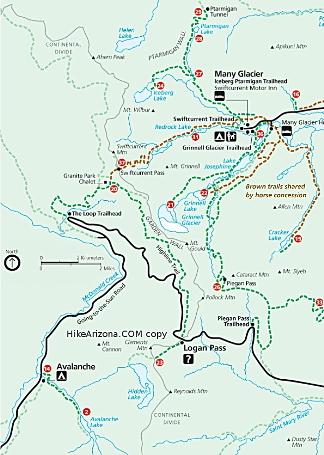
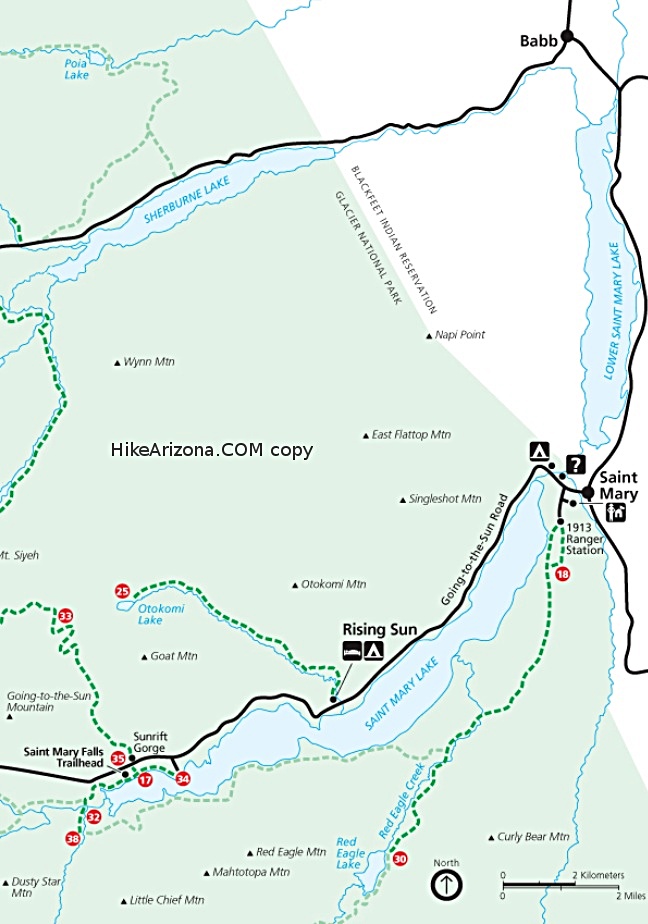
| Rose Creek Trail to Otokomi Lake
|
7.67 mi
1,700 ft |
|
|
| | |
| |
|
|
 Overview: Overview: This trail parallels the east side of Rose Creek. This creek drainage from St. Mary Lake to the headwaters of Otokomi Lake is dominated by a series of fast-moving water cascades, impressive waterfalls, and turquoise pools. One of the main enjoyments of this hike is to view the outstanding colorful rocks that make up the Rose Basin in which Otokomi Lake resides. The rock walls surrounding the lake are a deep, dark, throbbing red. Within this red basin bright green highlights of the stunted alpine Douglas firs and meadow grass seem to almost glow in a clear blue sky above. As you approach the lake basin, you cross a large talus slope and avalanche area where one can easily visualize the glacial action that carved this U-shaped valley where talus slopes come down from Goat Mtn at 8826' to Otokomi Lake. The remoteness of this lake with the striking view of the surrounding basin is a panorama of sheer beauty! Check out the Triplog. NoteThis is a moderately difficult hike. |
 Route Editor