Cinder Cone on east side of Kendrick Peak by fotogirl53
There are 2 Crater Lakes north of Flagstaff. One is located off FR 151 (Hart Prairie Road) and is private property that is posted/gated with "No Trespassing" signs. The second Crater Lake is in the Coconino National Forest on the east side of Kendrick Peak. It is accessible except for one section of the slope that is private property. The center of the cone is a meadow ringed with aspen, fir, and ponderosa. There is a small "lake" as the result of snowmelt and rain. A high clearance vehicle is needed due to poor road conditions for the last mile.
This area was involved in the Pumpkin Fire that consumed a large portion of Kendrick Peak. Crater Lake and the surrounding areas were saved due to hard work by the firefighters trying to protect the owl habitat and the parcel of private property adjacent to the cinder cone.
Hike: FR 9009D was blocked at the trailhead by a large fallen pine. You will see a "Road Closed" sign that is faded and is propped up against a tree. A little further up the trail is a sign detailing that another sign details what kind of access is permitted. However, the next sign has been broken. It is hard to tell just what is allowed! The 1/2 mile hike is a walk up the closed road with a 200' gain in altitude as the road winds up and around the crater to the top. The views of the San Francisco Peak and Kendrick Peak are amazing. The trail is covered in places with 2-3" ankle-rolling cinders. Nature is reclaiming the road toward the top, but the track is easily followed, ending in a hiker's gate through a barbed wire fence into the crater. Follow the trails down to the water or around the perimeter. You will see old-growth aspen, firs, and ponderosa, along with wildflowers and birds. This is Mexican spotted owl territory, and you may be lucky to see/hear one. You can cross the fence, go up to the rim, then walk around the entire crater. There are interesting volcanic outcrops to explore. This hike is beautiful in the fall when the aspen leaves have turned. But be careful during deer and elk hunting season: someone has built a blind.
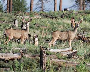
When you come back down, continue on FR 760. It loops back to Highway 180 through more forest and meadows. The deer are abundant in the late afternoon.
Gate Policy: If a gate is closed upon arrival, leave it closed after you go through. If it is open, leave it open. Leaving a closed gate open may put cattle in danger. Closing an open gate may cut them off from water. Please be respectful, leave gates as found. The exception is signage on the gate directing you otherwise.
WARNING! Hiking and outdoor related sports can be dangerous. Be responsible and prepare for the trip. Study the area you are entering and plan accordingly. Dress for the current and unexpected weather changes. Take plenty of water. Never go alone. Make an itinerary with your plan(s), route(s), destination(s) and expected return time. Give your itinerary to trusted family and/or friends.
Permit $$
no fees or permits reported
if incorrect tell us about it
Directions
Road
FR / Jeep Road - Car possible when dry
To hike From Flagstaff, drive north on Highway 180 for approximately 19 miles. There is a sign for FR 760--make a left turn. FR 760 takes you through ponderosa pines and grass meadows. Stay on FR 760 for approximately 2 miles and look for the marker for FR 9009D. Turn left and follow for approximately 1 mile. A large downed pine blocks the road at the trailhead. Look for the "Road Closed" sign that is propped up against the tree leading up the hill--that is the trail.
 Route Editor

 There are 2 Crater Lakes north of Flagstaff. One is located off FR 151 (Hart Prairie Road) and is private property that is posted/gated with "No Trespassing" signs. The second Crater Lake is in the Coconino National Forest on the east side of Kendrick Peak. It is accessible except for one section of the slope that is private property. The center of the cone is a meadow ringed with aspen, fir, and ponderosa. There is a small "lake" as the result of snowmelt and rain. A high clearance vehicle is needed due to poor road conditions for the last mile.