Route Editor

| Guide | ♦ | 14 Triplogs | 0 Topics |
details | drive | permit | forecast | route |
stats |
photos | triplogs | topics | location |
| 350 | 14 | 0 |
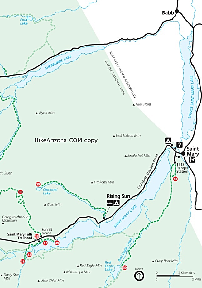
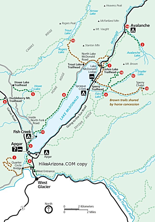
Avalanche! by tibber The trail begins as part of the Trail of the Cedars, which winds through spectacular virgin stands of hemlock and western red cedar. Most of the trail is a boardwalk through the boggy woods. The forest is quite old, determined to have last suffered a fire in the early 1500s!
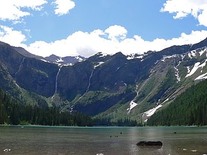
A short climb later, you come to a bit of a clearing where you can hear, and if you aren't afraid of heights, look over the edge at Avalanche Creek. If you stay on the trail, you are plenty far away from the edge. Near the lake, the trail breaks out of the trees, and you can see Bearhat Mountain on your left that forms the east wall of the valley while Mount Brown forms the west wall. When you get to the lake, you can't help but stop and look across at the huge cliffs across the way. Glacier water and lake water create some of the most beautiful waterfalls (where some of them merge is called Monument Falls) cascading down to the lake from the hanging cirque valley formed by Sperry Glacier, which cannot be seen from the lake. For those of you lucky enough to get to Avalanche Lake on a warm day soon after the trail opens in May, you will be treated to the sights and sounds of many avalanches, which is quite a sight if you have never seen one up close before.
Check out the Official Route and Triplogs. Leave No Trace and +Add a Triplog after your hike to support this local community. | |||||||||||||||||||||||||||||||||||||||||||||||||||||||||||||||||||||||||||||||||||||||||