 Route Editor

| Guide | ♦ | 150 Triplogs | 4 Topics |
details | drive | no permit | forecast | 🔥 route |
stats |
photos | triplogs | topics | location |
| 1.3k | 150 | 4 |
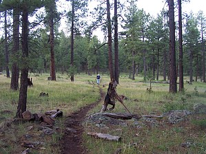
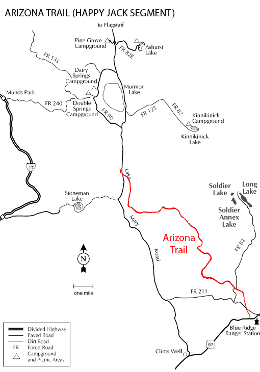
Meadows holding hands by HAZ_Hikebot   Overview OverviewPassage 28 begins at the Hay Meadow TH, immediately south of Highway 87 and FR 138 intersection. The trail crosses Highway 87 and heads north past Hay Meadow Tank and Hay Meadow Draw Tank, crosses FR 211, and drops into and follows Jack’s Canyon. It crosses FR 82 and soon FR 93D where it departs the former route. It passes Wochner and Waldroup Tanks and turns north towards the large Homestead Tank where it begins trending northwesterly before bending back north. It passes Foot In Tree Tank and continues north over gentle terrain through pinion-juniper and pine tree country before crossing FR 93A and an open meadow. Daves Tank is a quarter-mile northeast of the meadow crossing. The trail continues in a general northwesterly direction, climbs through pine trees until it drops slightly near Wild Horse Tank and an open area beyond which it again enters the trees and climbs slightly, then wraps around a ridge and heads west, crossing FR 294, to a trailhead at Bargaman Park—a large open area crossed by high voltage powerlines. Bargaman Park Tank on the west side of the park is a rather reliable water source. Trending west for a few miles, the trail crosses FR 135D and turns north, passes Shuffs Tank, re-crosses FR 135D, and continues north. It passes Maxie Tank, crosses FR 135, and skirts the west side of a small hill. A short distance past FR 6048 the trail enters an open area and heads northwesterly to reach Gooseberry Spring TH and the end of this passage. This is active cattle country so the fences and water tanks are maintained. Give the cows and wildlife unfettered access to the tanks by camping at least a quarter-mile from them. The trail goes through eighteen of the iconic AZT steel gates; please be sure to close them all.
Highway 87 From the intersection of AZ 87 and AZ 260 north of Pine, drive northeast 19.5 miles on AZ 87 then turn right (south) on FR 138. (This is about 0.8 miles west of the Blue Ridge Ranger Station on AZ 87.) Signs on the highway point to Moqui Campground. The trailhead is about 100 yards south on FR 138, on the left (east) side of the road. Northern Trailhead Gooseberry Springs Trailhead From the turnoff leading from Forest Highway 3 to Mormon Lake Village, continue south on Forest Highway 3 for approximately 5 miles and then turn left onto a prominent road (FR 92) on the south side of an open meadow, and drive 0.25 miles to a sharp left turn in the road; the trailhead and a steel AZT sign are on your right. You can also reach this point from AZ 87 by driving north on Forest Highway 3. Updated 2017-07-24 Gate Policy: If a gate is closed upon arrival, leave it closed after you go through. If it is open, leave it open. Leaving a closed gate open may put cattle in danger. Closing an open gate may cut them off from water. Please be respectful, leave gates as found. The exception is signage on the gate directing you otherwise.
Check out the Official Route and Triplogs. Leave No Trace and +Add a Triplog after your hike to support this local community. One-Way Notice This hike is listed as One-Way. When hiking several trails on a single "hike", log it with a generic name that describes the hike. Then link the trails traveled, check out the example. | |||||||||||||||||||||||||||||||||||||||||||||||||||||||||||||||||||||||||||||||||||||||||||||||||||||||||||||||||||||||||||||||||||||||||||||||||||||||||||||||||||||||||||||||||||||||||||||||||||||||||||||||||||||||||


