| Guide | ♦ | 11 Triplogs | 0 Topics |
details | drive | permit | forecast | route |
stats |
photos | triplogs | topics | location |
| 17 | 11 | 0 |
You know it's bad if the gub'ment has given up ... by paulshikleejr  Overview OverviewThis trail is officially a "forest service road." However, it is quickly becoming a de facto multi-use trail. I posted this guide to increase potential visitors' knowledge about this vital access route and its deteriorating condition. Warning This trail is prone to be very dusty. This road is tough to negotiate in a vehicle in multiple places. A rental Toyota RAV4 had trouble ascending a nasty spot in the rain, and a friend's Chevy Suburban damaged a 4WD actuator at another spot in dry conditions.
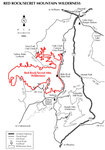
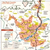
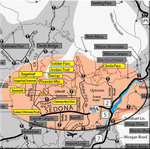
Forest Service Road 152 (FR152) (also known as Dry Creek Road and Vultee Arch Road) has been used for many years as the way to drive to multiple trailheads (listed below) leading into the Red Rock-Secret Mountain Wilderness from the south and west and the North Urban Trail System from the north. Over time, the condition of the road has deteriorated considerably. In May 2010, it was said that the Forest Service did some work on this road in an attempt to improve driveability. Since that time, the road has again become much less useable and virtually impassable in some areas by passenger cars. As of Summer 2012, rangers are actively warning would-be visitors about the hazards of trying to drive this trail in anything other than a high profile, short wheelbase vehicle. As of November 2012, rangers tell people that the Forest Service has given up on trying to save the road. In recognition of this trail's importance as a point of access, on September 18, 2012, the forest service promulgated a press release about "the new Dry Creek Vista Trailhead" which will include "paving the first quarter-mile of FR 152 [from the main road] and [a new] parking area." Furthermore, "The new trailhead is located approximately one-quarter mile up the Vultee Arch Road and will provide day-use recreation, a restroom facility, and access to some prevalent trails. This site is proposed to be included in the Red Rock Pass program once complete, and will provide all recreation amenities required for a day-use fee area under the National Recreation Enhancement Act." As of November 2012, no Red Rock Pass is yet required. Hike It is increasingly common to see individuals and groups using FR152 as a wide and easy to follow hiking trail. As one walks/runs/bikes/drives along the trail, it is common to see vehicles parked (abandoned for the moment?) by the side of the road at odd places as drivers decide, "That's far enough. I don't want to risk going in any further. Two extra miles to the trailhead isn't that far, right?" Nearer to the paved road, you'll see passenger cars. As you get further in, you'll begin to see SUVs. The primary hazards to watch out for are folks braving the drive to get to their desired starting point, jeeps ferrying wide-eyed and nauseated tourists, and (most importantly) trail dust. Trail dust is a notable hazard because it covers much of the trail and can whip up into your lungs and eyes quickly (even if there isn't a vehicle passing by). As mentioned above, FR152 is the spine providing access to a number of trails. A very short 0.11 mile from the main road, on the northern side is the first opportunity to access the Chuckwagon Trail. Up 1.24 miles (at the 1.35 mile mark) to the south is the access point for Devil's Bridge Trail #120. Another 1.00 mile (at the 2.35 mile mark) up the trail to the west is the intersection with FR9917. That short road leads to the ruins of a cabin and provides access to the Chuckwagon Trail. A quick 0.14 mile further (at the 2.49 mile mark) to the east is the access point to the Brins Mesa Trail #119 and to the west a terminal for the Chuckwagon Trail. The 3.58-mile Brins Mesa Trail terminates at the Jim Thompson Trailhead at the north end of Jordan Road after linking along the way with the Cibola Pass Trail (thereby providing access to the North Urban Trail System). After passing the really bad spot for vehicles trying to exit the area (especially in wet or icy conditions), 0.94 mile further (at the 3.43 mile mark) is the access point for the Secret Canyon Trail. This trailhead is particularly rich in that the Secret Canyon Trail, HS Canyon Trail, and David Miller Trail all branch from this point. Finally, at the end of the trail, 4.36 miles in, is the Vultee Arch Trailhead. This is arguably the richest access point as the Vultee Arch Trail, Sterling Pass Trail, Dry Creek Trail, and Bear Sign Trail emanate. The eastern end of the Sterling Pass Trail terminates on Arizona 89A, and the David Miller Trail terminates on the Bear Sign Trail providing access to Secret Canyon trails. Water Sources It is claimed in multiple sources, including on the Wilson Mountain, AZ USGS 1:24K Topographic Map, and MapDEX , that there is a water source called "Earl's Tank" about 0.2 mile from FR152 at its closest approach. However, "satellite" views of that area do not show a "reservoir" as claimed. Inquiries should be made to knowledgeable authorities before depending on the availability of water at this site. Camping Although there is NO camping along FR152 itself, should be many opportunities for dispersed camping along the Brins Mesa, HS Canyon, Secret Canyon, David Miller, Bear Sign, Dry Creek, and Sterling Pass Trails. Having camped along the Secret Canyon Trail (and to date, only that trail), I can attest to the fact that "nice" campsites are available on the Secret Canyon Trail. Check out the Official Route and Triplogs. Leave No Trace and +Add a Triplog after your hike to support this local community. One-Way Notice This hike is listed as One-Way. When hiking several trails on a single "hike", log it with a generic name that describes the hike. Then link the trails traveled, check out the example. | |||||||||||||||||||||||||||||||||||||||||||||||||||||||||||||||||||||||||||||||||||||||||||||||||||||||||||||||||||||||||||||||||||||||||||||||||||||||||||||||||||||||||||||||||
 Route Editor


