 Route Editor

| Guide | ♦ | 3 Triplogs | 0 Topics |
details | drive | no permit | forecast | map |
stats |
photos | triplogs | topics | location |
| 34 | 3 | 0 |
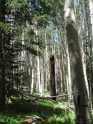
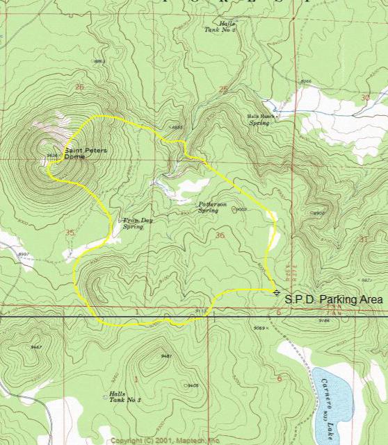
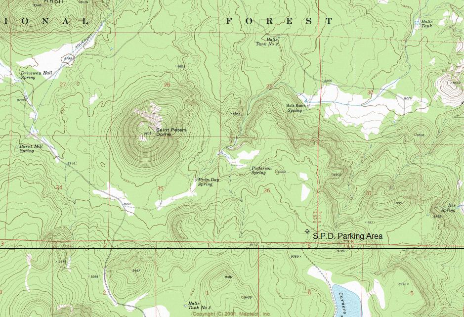
Cross-Country Loop by ssk44  The "Saint Peters Dome Wildlife Habitat Area" is located in the White Mountains within the Apache-Sitgreaves National Forest. The boundaries for the wildlife area are FR118 to the north, FR117A to the east, and FR117 to the west. There is no southern boundary due to FR117 and FR117A intersecting to a point. The "Saint Peters Dome Wildlife Habitat Area" is located in the White Mountains within the Apache-Sitgreaves National Forest. The boundaries for the wildlife area are FR118 to the north, FR117A to the east, and FR117 to the west. There is no southern boundary due to FR117 and FR117A intersecting to a point.Habitat Area Regulations/Information This area is closed to the use of all motorized vehicles to provide a "quiet area" for wildlife free from vehicle disturbance and protect habitat components of vegetation, soils, and water. The Wildlife Habitat Area program is a cooperative partnership between the Apache-Sitgreaves National Forest and the Arizona Game and Fish Department to enhance habitat conditions and effectiveness for wildlife. This area is open to non-motorized activities, including hiking, horseback riding, mountain biking, wildlife viewing, hunting, and fishing.
The cross-country loop that I chose was approximately 6 miles with elevations ranging from 8,667 to 9,629, with a total climbing feet of 1,425 (see attached map). This may not seem like much of a hike, but when you live in the desert, a hike like this feels more like 10 miles. It is best to plan on a little less distance and total-climbing feet than you normally might do when hiking above 9,000 feet. This was a very diverse loop with lots of opportunities to view wildlife, including bear and elk. The quieter you are, the more you will see. The best way to climb Saint Peters Dome is a ridge on the Northeast slope due to elevation contours that are a little more user-friendly. The Saint Peters Dome Wildlife Habitat Area offers something for everyone. A short scenic nature walk or an ambitious adventure hike. The route is yours to choose, with the unknown being part of the adventure. Enjoy.
Check out the Triplogs. Leave No Trace and +Add a Triplog after your hike to support this local community. One-Way Notice This hike is listed as One-Way. When hiking several trails on a single "hike", log it with a generic name that describes the hike. Then link the trails traveled, check out the example. | ||||||||||||||||||||||||||||||||||||||||||||||||||||||||||||||||||||


