Route Editor

| Guide | ♦ | 2 Triplogs | 0 Topics |
details | drive | no permit | forecast | map |
stats |
photos | triplogs | topics | location |
| 31 | 2 | 0 |
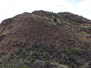
  Overview: Peak 2640 is located in the Teapot Mountain Quadrangle in Pinal County. With a rise of 440' and an elevation of 2640' it ranks #5633 for the state of Arizona. Its summit coords are: 33.1306 -111.0751 Overview: Peak 2640 is located in the Teapot Mountain Quadrangle in Pinal County. With a rise of 440' and an elevation of 2640' it ranks #5633 for the state of Arizona. Its summit coords are: 33.1306 -111.0751Check out the Triplogs. Leave No Trace and +Add a Triplog after your hike to support this local community. | |||||||||||||||||||||||||||||||||||||||||||||||||||||||||||||||||||||