username
X
password
register
for free!
help


Peak 3316 - Maverick Mtn Quad, AZ

Guide 1 Triplog  0 Topics
  2 of 5  
Fav
Wish
0
details
drive
no permit
forecast
map
stats
photos
triplog
topics
location
50 1 0
Statistics
tap row or icons for details
Difficulty 1.5 of 5
Distance Round Trip 0.9 miles
Trailhead Elevation 2,848 feet
Elevation Gain 467 feet
Accumulated Gain 490 feet
Kokopelli Seeds 3.35
 Interest Off-Trail Hiking & Peak
unreported if dogs are allowed
editedit > ops > dogs to adjust
feature photo
Photos Viewed All MineFollowing
50  2012-10-23 CannondaleKid
Author
author avatar Guides 16,843
Routes 17,472
Photos 24
Trips 1 map ( 6 miles )
Age 28 Male Gender
Location HAZ, TrailDEX
Associated Areas
list map done
Phoenix Region
Historical Weather
Trailhead Forecast
Expand Map
Preferred Mar, Nov, Feb, Jan
Sun  6:03am - 6:47pm
0 Route
 
0 Alternative


remove free decal offer

  
Guide Needed
Publish Full Detail Guide


Use +Add above to share photos and triplogs
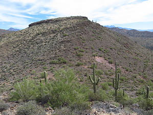
Overview: Peak 3316 is located in the Maverick Mountain Quadrangle in Maricopa County. With a rise of 456' and an elevation of 3316' its Arizona Peaks Rank is 4785. Its summit coords are: 33.7584 -111.5839


    Check out the Triplog.
    Leave No Trace and +Add a Triplog after your hike to support this local community.
    WARNING! Hiking and outdoor related sports can be dangerous. Be responsible and prepare for the trip. Study the area you are entering and plan accordingly. Dress for the current and unexpected weather changes. Take plenty of water. Never go alone. Make an itinerary with your plan(s), route(s), destination(s) and expected return time. Give your itinerary to trusted family and/or friends.

     Permit $$
    no fees or permits reported

    if incorrect tell us about it


     Directions
    or
     Road
    Strictly 4x4

    To hike
    Take AZ87 north to the Four Peaks/Sycamore Creek Roads intersection. Turn left onto FR402 and continue until it becomes FR1857, then right onto FR1855, then left onto FR1856, right onto FR1096A, right onto FR160B, left onto FR1062 and follow to the trailhead coords.
    page created by CannondaleKid on Dec 30 2012 2:52 pm
     90+° 8am - 6pm kills
    helpcorrectionissue

    end of page marker