The Hayden survey party discovered Yellowstone Natural Bridge in 1871. Yellowstone became the first National Park in 1872. The Natural bridge was opened to the public in 1881 after development of a trail that went across the bridge. There were even plans to build a road across the bridge but that never developed. Today the trail goes around the bridge offering views from every angle.
This natural bridge is a rock outcropping made up primarily of rhyolite, which resembles granite and has resulted due to erosion caused by Bridge Creek which flows thru the natural bridge. The natural bridge is 51 feet high and spans a distance of 29 feet.
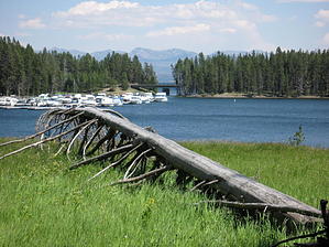
The family friendly trailhead is located in the Bridge Bay parking lot. There are facilities, water and a general store available at the trailhead. The trail departs at the north end of the parking lot and heads towards the campground. As the campground becomes visible turn left at the marked intersection. The trail enters a forested area made up primarily of lodge pole pines. Some nice views of Bridge Bay are soon in sight and generally wildflowers are plentiful throughout the summer. At about one mile the trail meets with a paved single lane road. Take this road to the right. The road is paved for only a short distance and then turns to stone. At the approaching Y intersection, the road goes to the left. Take the trail to the right and continue to the interpretive site at the base of the natural bridge. Enjoy it from here or take the steep serpentine trail to the right of the natural bridge to the top and view the natural bridge from behind and above. It's a great place for a casual picnic lunch. Continue on this trail to make a loop around and return to the interpretive site. Be bear aware especially in the spring when the bears frequent the area as they feed on spawning trout in Bridge Creek. From the interpretive site return to the trailhead the way you came.
WARNING! Hiking and outdoor related sports can be dangerous. Be responsible and prepare for the trip. Study the area you are entering and plan accordingly. Dress for the current and unexpected weather changes. Take plenty of water. Never go alone. Make an itinerary with your plan(s), route(s), destination(s) and expected return time. Give your itinerary to trusted family and/or friends.
Permit $$
NPS
Yellowstone National Park Entrance Fees $25 per car & $12 per person
Directions
Road
Paved - Car Okay
To hike The trailhead is located in the Bridge Bay Marina parking lot one mile south of Lake Village in Yellowstone National Park.
 Route Editor