Route Editor

| Guide | ♦ | 1 Triplog | 0 Topics |
details | drive | no permit | forecast | 🔥 route |
stats |
photos | triplog | topics | location |
| 33 | 1 | 0 |
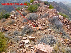
  Overview OverviewWhitford Triangulation Benchmark - Picketpost Mtn Quadrangle, Pinal County, Az In Whitford Canyon, Tonto National Forest With a rise of 758 Ft and an elevation of 3,569 Ft (NGVD 29) Summit coordinates: 33.337235 -111.143468 Check out the Official Route and Triplog. Leave No Trace and +Add a Triplog after your hike to support this local community. | ||||||||||||||||||||||||||||||||||||||||||||||||||||||||||||||||||||||||||||||||||||