Route Editor

| Guide | ♦ | 56 Triplogs | 0 Topics |
details | drive | no permit | forecast | map |
stats |
photos | triplogs | topics | location |
| 170 | 56 | 0 |
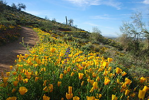
Lots of Options by MEWhiteman  The Phoenix Sonoran Preserve has been in the planning stages for many years. A trail system was built a couple of years ago in the southern part of the park, which is now being actively used. In mid-2012, another network of trails was completed in the northern section of the park on the south side of Carefree Highway. The new Dove Valley Road / Sonoran Desert Drive, completed in May 2013, divides the northern and southern sections. (This segment of Dove Valley Road should not be confused with the Dove Valley Road on the north side of the park, which allows access to some of the trails. They do not connect.) The Phoenix Sonoran Preserve has been in the planning stages for many years. A trail system was built a couple of years ago in the southern part of the park, which is now being actively used. In mid-2012, another network of trails was completed in the northern section of the park on the south side of Carefree Highway. The new Dove Valley Road / Sonoran Desert Drive, completed in May 2013, divides the northern and southern sections. (This segment of Dove Valley Road should not be confused with the Dove Valley Road on the north side of the park, which allows access to some of the trails. They do not connect.)This new trail system goes around and over a line of hills stretching southeast from Carefree Highway west of 7th Avenue to Apache Wash. The trails in this section are interconnected, such that many loop as well as in and out hiking opportunities exist. I'd describe it as a large loop with trails and junctions connecting both sides of the loop to create smaller loops. There are also several side trails leading to the concrete multi-use trail called the Sonoran Paseo paralleling the new road as well as a couple of spur trails leading to hilltops providing excellent views of the surrounding park. Several access points are providing different options for starting the hikes enabling one to hike different areas without a long hike in from the main trailheads. The large, outside loop, comprised of the Sidewinder and Ocotillo trails, is 13.7 miles long. The shorter loop possibilities begin at about 2 miles and go up from there. Several combinations for different loop hikes are posted as GPS tracks. I used an arbitrary median distance and AEG in the statistics for this description as there is wide variation depending on the trek. The trails themselves are well constructed, graded, and the hills are not steep, making for excellent hiking, mountain biking, and riding. There is very little shade. The trails are well marked with stickers on steel posts using the same format as in the southern area of the park. They contain the trail name, mileage, elevation profile, and a QR code to allow smartphone owners to get additional information. A letter on a colored background allows easy trail identification. Check out the Triplogs. Leave No Trace and +Add a Triplog after your hike to support this local community. | |||||||||||||||||||||||||||||||||||||||||||||||||||||||||||||||||||||||||||||||||||