Route Editor

| Guide | ♦ | 3 Triplogs | 0 Topics |
details | drive | no permit | forecast | 🔥 route |
stats |
photos | triplogs | topics | location |
| 81 | 3 | 0 |
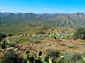
  Overview OverviewGranite Mountain - Teapot Mountain Quad, Pinal County, Az With a rise of 1,072 Ft and an elevation of 4,052 Ft Summit coordinates: 33.162333 -111.026917 GRANITE MOUNTAIN Triangulation Station (1935), on highest peak. Check out the Official Route and Triplogs. Leave No Trace and +Add a Triplog after your hike to support this local community. | |||||||||||||||||||||||||||||||||||||||||||||||||||||||||||||||||||||||||||||