Route Editor

| Guide | ♦ | 3 Triplogs | 0 Topics |
details | drive | permit | forecast | route |
stats |
photos | triplogs | topics | location |
| 8 | 3 | 0 |
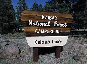
Williams' Watering Hole by Hippy   Kaibab Lake Recreation Site covers roughly 45 acres of National Forest and houses less than 2 miles of paved roads, an amphitheater, boat dock, camping sites, and one quaint restroom. Kaibab Lake Recreation Site covers roughly 45 acres of National Forest and houses less than 2 miles of paved roads, an amphitheater, boat dock, camping sites, and one quaint restroom.Though boating and fishing are allowed, swimming is not permitted in the less than 40 foot deep Kaibab Lake. It is a water source for the city of Williams. The lake is stocked with rainbow, brown, and brook trout, an angler's dream lake... in Williams.
If you find yourself stuck in Williams for a few days, with nothing to do and a fishing pole in hand... this is probably the best place to go to hook a trout. Other than that, you don't need to add this to your "To Do" list. Check out the Official Route and Triplogs. Leave No Trace and +Add a Triplog after your car camp trip to support this local community. | ||||||||||||||||||||||||||||||||||||||||||||||||||||||||||||||||||||