Route Editor

| Guide | ♦ | 1 Triplog | 0 Topics |
details | drive | no permit | forecast | map |
stats |
photos | triplog | topics | location |
| 10 | 1 | 0 |
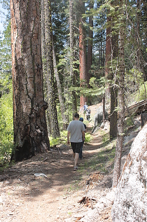
steady on the tree bridge by lP14 The hike starts near the Pinecrest Reservoir Marina, on the four mile lake loop trail. You follow the loop trail north, dodging the many humans fishing and meandering around the lake, for maybe .25-.33 miles. Immediately across the dam the unsigned trail to Strawberry branches off to the left and descends down to the Stanislaus River. (To continue on the lake loop, you would follow the trail straight, up a slight incline.)
At a couple points you will see trees bridging the river. About a mile in, the trail leads directly to one of these trees and there is a rope set up to help steady you across. Soon after this you will come to a dirt road. Take a left onto this and head toward some cabins and a paved road. Follow this about a quarter of a mile until you come to the Strawberry general store and Sonora Pass, and a bar across the street. Return the way you came. Check out the Triplog. Leave No Trace and +Add a Triplog after your hike to support this local community. | ||||||||||||||||||||||||||||||||||||||||||||||||||||||||||||||||||||||||||||||||