 Route Editor

| Guide | ♦ | 27 Triplogs | 3 Topics |
details | drive | permit | forecast | 🔥 route |
stats |
photos | triplogs | topics | location |
| 179 | 27 | 3 |
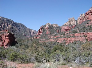
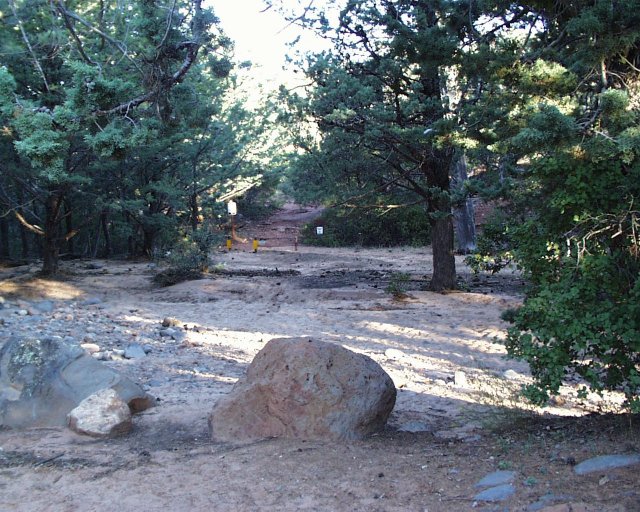
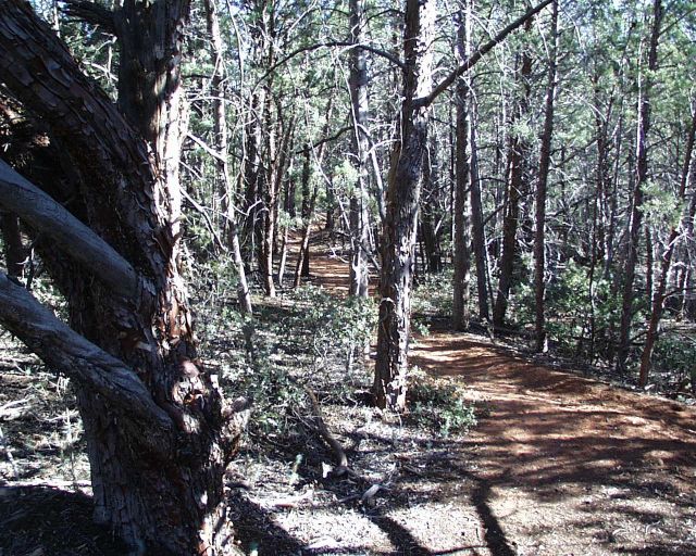
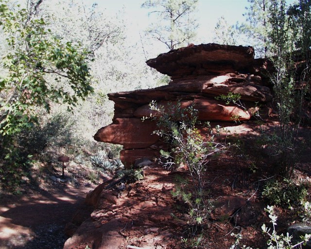
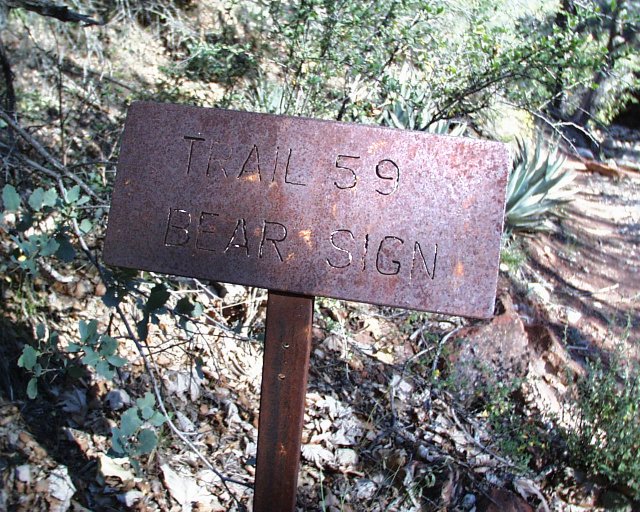
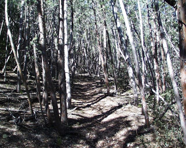
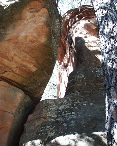
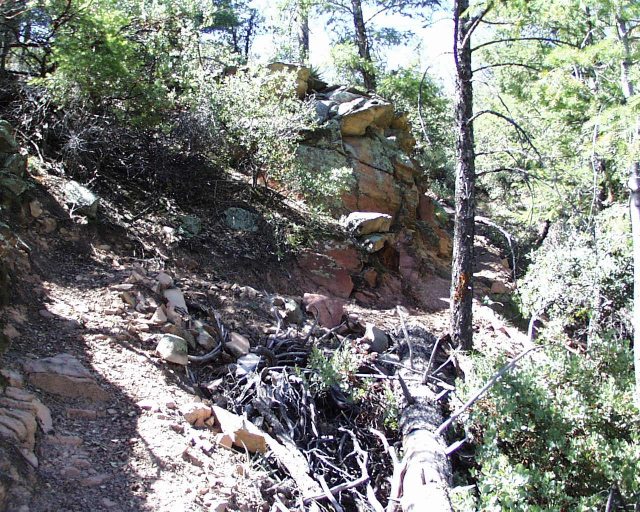
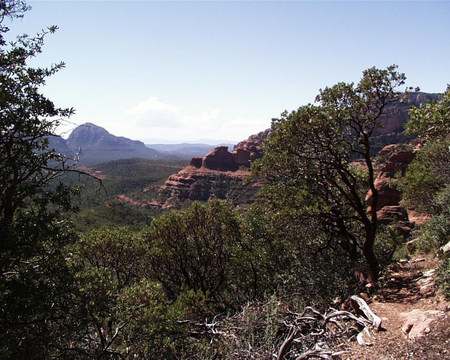
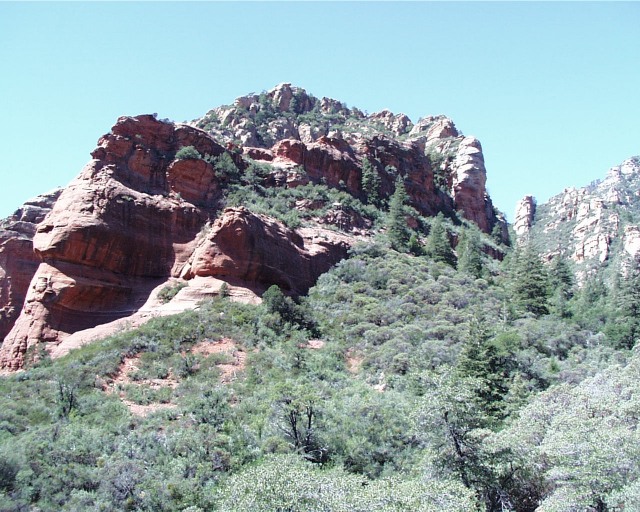
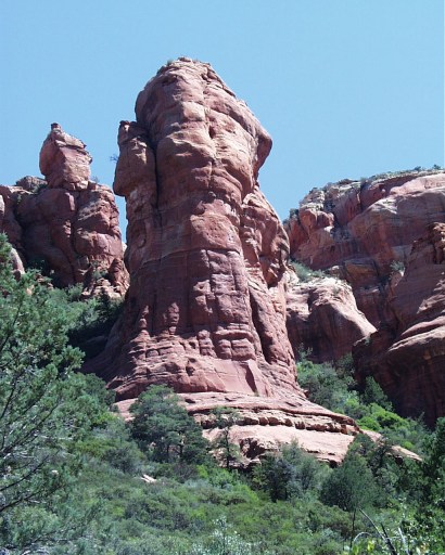
Red Rock Sampler by annette   The hike begins at the Dry Creek trailhead after you cross Dry Creek (which was dry, thus living up to its name). The trail is very wide with gentle rises and is rather like walking through typical woodlands in the heart of America except for the occasional glimpse of red here and there along the way. The hike begins at the Dry Creek trailhead after you cross Dry Creek (which was dry, thus living up to its name). The trail is very wide with gentle rises and is rather like walking through typical woodlands in the heart of America except for the occasional glimpse of red here and there along the way.At mile 0.7, the Bear Sign Canyon Trail veers off to the left with the Dry Creek Trail continuing to the right. Between the two trails is a beautiful red rock marking the entrance to Bear Sign Canyon. The trail marker for Bear Sign is just beyond the rock on the left side of the trail. The canyon narrows and then widens, repeating this several times. When it opens, it treats viewers to some loftier red-rock scenery. Red twisted trunks of many manzanita trees add a beautiful contrast to the grays and greens of the forest. There are a few creek crossings, but most of the trail is close along the creek next to canyon walls. At one point, there is a collection of tall free-standing red rocks in the middle of the canyon. Unlike our great expectations for ?Bear Sign?, we only saw one incidence of bear scat along the trail.
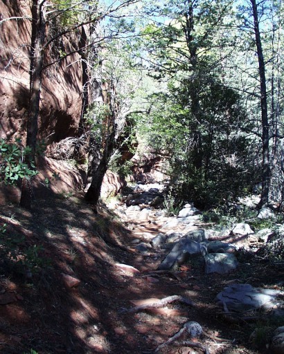
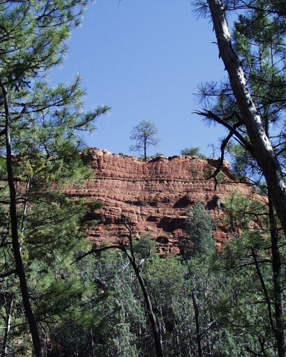
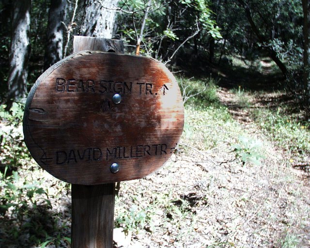
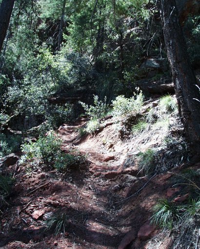
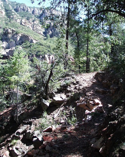
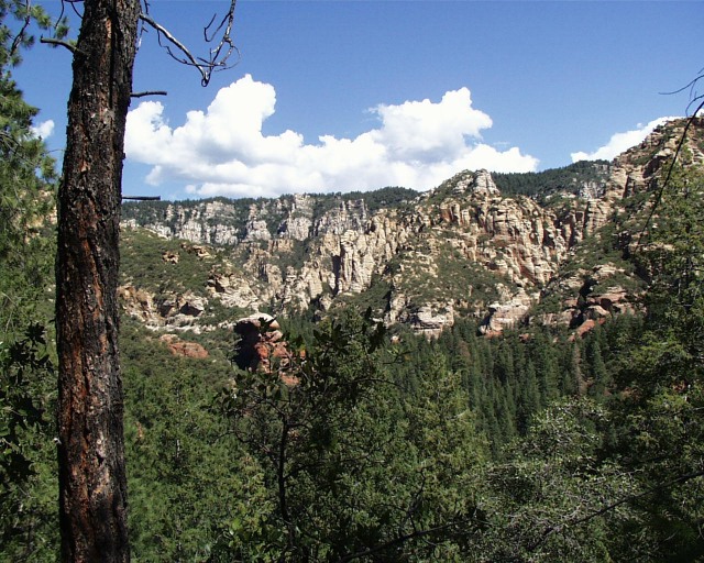
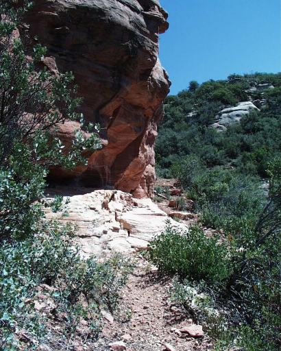
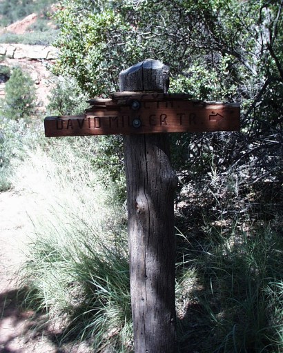
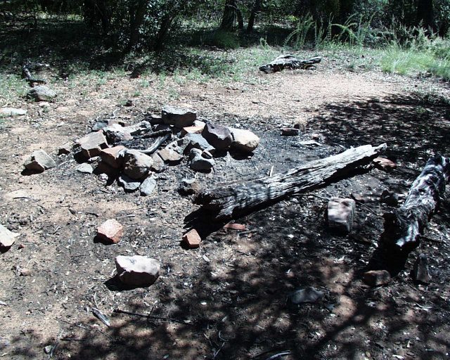
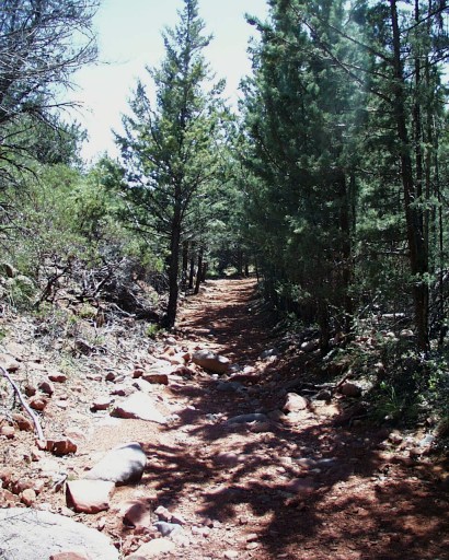
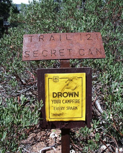
 At 2.0 miles in you arrive at the trail marker for the David Miller Trail which is a cross-over trail which connects Bear Sign Canyon to the Secret Canyon Trail. Bear Sign Canyon continues on toward the right. We took the David Miller Trail which ascends 100+ feet in actual elevation before it tops out to begin the descent into Secret Canyon. The beginning of this trail is not too bad, but quickly degenerates into a very narrow trail with many switchbacks and a lot of loose red dirt and woodland debris, so be sure to watch your footing. When you feel you are in a stable position, be sure to turn around to catch some great views of Bear Sign Canyon. At 2.0 miles in you arrive at the trail marker for the David Miller Trail which is a cross-over trail which connects Bear Sign Canyon to the Secret Canyon Trail. Bear Sign Canyon continues on toward the right. We took the David Miller Trail which ascends 100+ feet in actual elevation before it tops out to begin the descent into Secret Canyon. The beginning of this trail is not too bad, but quickly degenerates into a very narrow trail with many switchbacks and a lot of loose red dirt and woodland debris, so be sure to watch your footing. When you feel you are in a stable position, be sure to turn around to catch some great views of Bear Sign Canyon.This picture was taken of the view into Secret Canyon from the highest point of the David Miller Trail. The Secret Canyon side of the David Miller Trail is a very stark contrast to the other. Here you begin the descent through rocky switchbacks around sandstone rocks and ledges in full-sun. Where the other side was very closed in and shady, here you see sweeping panoramic views. Once off the rocks, the trail joins with the Secret Canyon Trail which continues to the right into the narrowing portion of the canyon or leads out to the trailhead to the left. This particular spot was a very wide-open level area with a huge shade tree and a nearby campfire ring. Looked like a great spot to camp. The trail from this point out is rather wide and often sandy. One red-rock formation on the left looked rather strange as if someone had risked life and limb to perfectly place same-size boulders in a ring partway up the gently sloping base. After reaching the Secret Canyon Trailhead, you will see on your right a memorial to Wilderness Ranger David Miller. From this point cross over Dry Creek, climb up to the trailhead parking lot, and walk down FR 152 to your left until you arrive once again at the Dry Creek / Vultee Arch Trailhead parking area or (if you haven't had enough already) head down the creek instead as it follows closely to the road the entire time. NOTE: A very appropriate beginning to this adventure was our camping out the night before near the Dry Creek trailhead (very close to Bear Sign Canyon): what sounded like a cub in distress kept us awake most of the night. A couple of times between 3 and 4 AM, what sounded like a large bear looking for the cub, moved through the creek very near us making some very dissatisfied noises!!!
Check out the Official Route and Triplogs. Leave No Trace and +Add a Triplog after your hike to support this local community. One-Way Notice This hike is listed as One-Way. When hiking several trails on a single "hike", log it with a generic name that describes the hike. Then link the trails traveled, check out the example. | |||||||||||||||||||||||||||||||||||||||||||||||||||||||||||||||||||||||||||||||||||||||||||||||||||||||||


