 Route Editor

| Guide | ♦ | 8 Triplogs | 0 Topics |
details | drive | no permit | forecast | map |
stats |
photos | triplogs | topics | location |
| 175 | 8 | 0 |
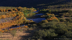
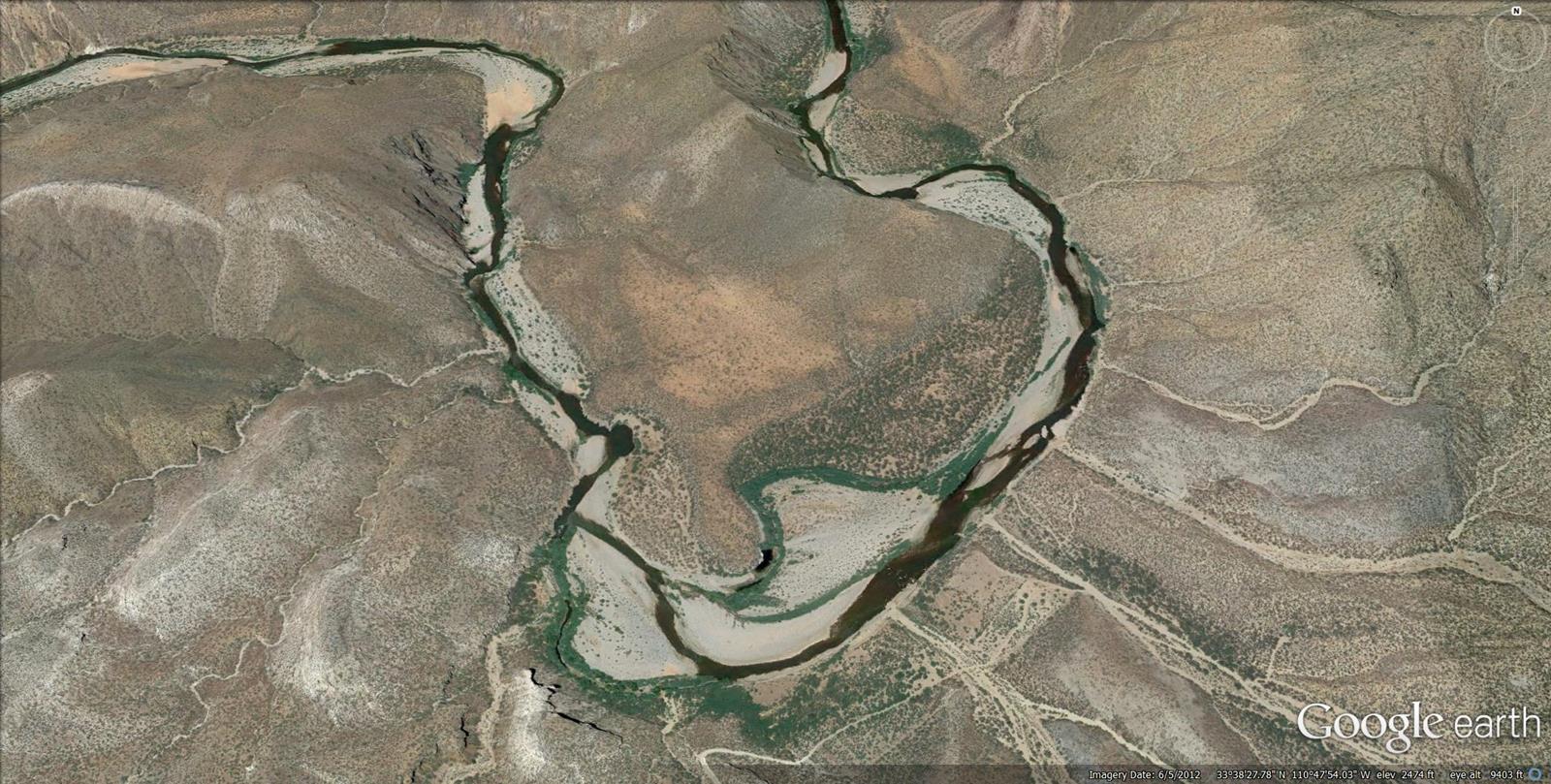
  A beautiful segment of the Salt River, within the Salt River Canyon Wilderness. The terrain is classic Sonoran desert and the location sits in the shadow of nearby Rockinstraw Mountain to the southwest. Activities consist of hiking, backpacking, swimming, and fishing. All river hiking is easy to moderate and all off-trail. Recommended route options are both upstream and downstream with multiple swimming/fishing holes. The trailhead parking area is located above the river at a large permanently locked gate put in place by the Tonto National Forest. Vehicle river access is not available. A beautiful segment of the Salt River, within the Salt River Canyon Wilderness. The terrain is classic Sonoran desert and the location sits in the shadow of nearby Rockinstraw Mountain to the southwest. Activities consist of hiking, backpacking, swimming, and fishing. All river hiking is easy to moderate and all off-trail. Recommended route options are both upstream and downstream with multiple swimming/fishing holes. The trailhead parking area is located above the river at a large permanently locked gate put in place by the Tonto National Forest. Vehicle river access is not available.
Check out the Triplogs. Leave No Trace and +Add a Triplog after your hike to support this local community. One-Way Notice This hike is listed as One-Way. When hiking several trails on a single "hike", log it with a generic name that describes the hike. Then link the trails traveled, check out the example. | |||||||||||||||||||||||||||||||||||||||||||||||||||||||||||||||||||||||||||||||||||||||||||||||||||||||||||||||||||||||||||||||||||||||||||||||||||||||||||


