Route Editor

| Guide | ♦ | 3 Triplogs | 0 Topics |
details | drive | no permit | forecast | map |
stats |
photos | triplogs | topics | location |
| 35 | 3 | 0 |
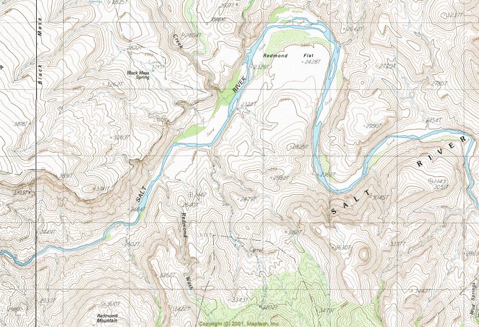
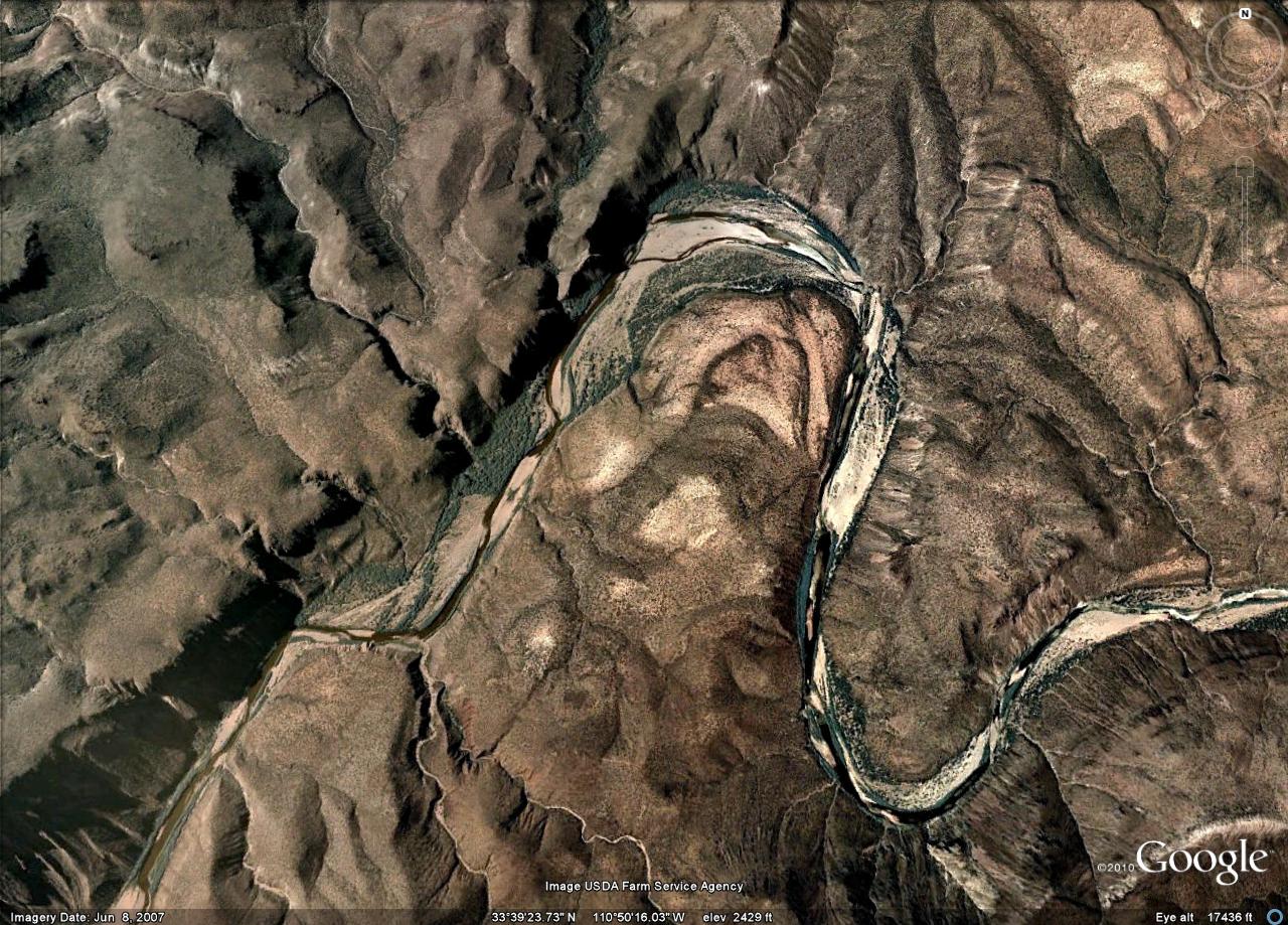
Wilderness Solitude by ssk44   The Salt River Canyon Wilderness is located within the Tonto National Forest. The Wilderness area was established in 1984 and covers 32,100 acres of land. The main boundaries are Highway 288 on the west side and the bridge over Highway 60 to the east. There are approximately 52 river miles within the Wilderness. Elevations range from 2,200 feet to 4,200 feet. There are only three access points within the Tonto National Forest which are Gleason Flat via Seven Mile Wash off Highway 60, Horseshoe Bend, and Redmond flat via Highway 88 from Globe. The terrain is very rugged with steep mountains, cliffs, and spine ridge tops. Vegetation within the area is typical Sonoran Desert with plants such as various cactus, ocotillo, palo verde, and creosote bushes. The upper elevations offer oak, manzanita, and juniper. This area receives a good amount of rain throughout most seasons so vegetation is lush and healthy. The Salt River Canyon Wilderness is located within the Tonto National Forest. The Wilderness area was established in 1984 and covers 32,100 acres of land. The main boundaries are Highway 288 on the west side and the bridge over Highway 60 to the east. There are approximately 52 river miles within the Wilderness. Elevations range from 2,200 feet to 4,200 feet. There are only three access points within the Tonto National Forest which are Gleason Flat via Seven Mile Wash off Highway 60, Horseshoe Bend, and Redmond flat via Highway 88 from Globe. The terrain is very rugged with steep mountains, cliffs, and spine ridge tops. Vegetation within the area is typical Sonoran Desert with plants such as various cactus, ocotillo, palo verde, and creosote bushes. The upper elevations offer oak, manzanita, and juniper. This area receives a good amount of rain throughout most seasons so vegetation is lush and healthy.Activities within the Wilderness area typically consist of white water river rafting and fishing. However, some very rewarding cross-country hiking opportunities do exist for those that are a little on the ambitious side. No maintained trails exist within the wilderness area.
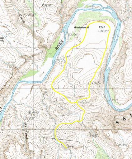
The route I chose for this particular trip was in September and relatively short due to rising temperatures. I started at 6:00 AM with the morning temp. surprisingly only about 70 degrees. I was not anticipating an enjoyable hike for this trip. What started in my head as a questionable trip turned out to be a great day. The temperatures were mild throughout the morning and did not begin to become uncomfortable till after 10:30 AM. Hiking this area in September after all of the monsoon storms offers some very rewarding photography because the vegetation is so rich and green. This area is unspoiled and truly beautiful. My hike was a 6 3/4 mile lasso loop. I hiked into the mountains northeast of the corral and worked my way along a ridge above the river and eventually out onto Redmond Flat. The Salt River was still somewhat swollen and muddy from summer monsoon storms. I wrapped up the hike around 11:30. Hiking in the Salt River Canyon Wilderness consists of rugged cross-country bushwhacking, canyoneering, and sand washes. The best time of year for hiking in this area is in the winter months. This is a very special, lightly used area that is only about 1.50 hours from Mesa, AZ. Typically the words "solitude" and "close to town" could never be used in the same sentence but that is the best description for the Salt River Canyon Wilderness. The route is yours to choose with the unknown being part of the adventure.
Check out the Triplogs. Leave No Trace and +Add a Triplog after your hike to support this local community. | ||||||||||||||||||||||||||||||||||||||||||||||||||||||||||||||||||||||||||||||||||||||||||||||