Start at the Heart Lake Trailhead. The trail heads up a couple of switchbacks through an aspen forest before breaking out of the forest into an open brush covered slope. Soon you'll reach another switchback turn. This is where you depart from the Heart Lake Trail. You will head west on an unmarked trail into a small pine forest. The trail then turns north and heads up the southern slope of Sherwin Ridge. Gradually, the trail turns to a more northeasterly direction and heads up a very steep slope. Shortly, the trail flattens to a more gradual slope.
At this point the trail begins to disappear as you approach a pine forest. From here everything to the left (west) is what I call the west ridge. The west ridge is all lower elevation that the east ridge on up to Pyramid Peak. Most of the ridge on the west side is between 9,000 and 10,000 feet. The entire hike on the ridge is a cross country hike over small brush.
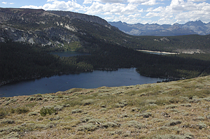
I’ve seen deer and bear up here. There are great views of the Mammoth Lakes Basin and Mammoth Crest to the south and the town of Mammoth Lakes to the north. At the western most end of the ridge only the canyon the Mammoth Creek runs through separates Sherwin Ridge from Mammoth Mountain. These are some of the best views of the eastern side of Mammoth Mountain.
WARNING! Hiking and outdoor related sports can be dangerous. Be responsible and prepare for the trip. Study the area you are entering and plan accordingly. Dress for the current and unexpected weather changes. Take plenty of water. Never go alone. Make an itinerary with your plan(s), route(s), destination(s) and expected return time. Give your itinerary to trusted family and/or friends.
To hike From the town of Mammoth Lakes, take Lake Mary Road to the lakes. Turn left onto Lake Mary Loop Road. When the road rounds Lake Mary at the eastern end of the lake the road reaches the Coldwater Creek Campground. Turn left into the campground and head up the campground road all the way to the parking lot at the end of the road. Drive all the way around the parking lot to the north side and park at the Heart Lake Trailhead.
 Route Editor