The Sunflower Trail #344 starts at the junction with the Little Saddle Mountain Trail #244 approximately a half-mile from the Cross F Trailhead. Its total length is approximately 5.1 miles, where it joins the Boulder Creek Trail about a half-mile east of SR87 and just east of the ranch that now has the "TOPLESS CABARET" sign that is so conspicuously prominent. The total elevation change is about 500', but there are a few uphill climbs on your way down.
After the junction with the Little Saddle Trail, the trail heads into a canyon, where it becomes rather faint in places. After crossing a wash, it rises back up to meet FR393 at the 0.6-mile mark. There you will walk under some relatively low powerlines. The trail descends again into another small canyon between two buttes until you get to a cattle tank. You encounter the first of several gates at this tank and begin to follow what appears to be an old ATV road at the 1.4-mile mark. The terrain here is mainly open grassland. At 1.7 miles, this junctions with a more prominent ATV road. A plastic "Trail #344" marker is there. Head east on this new ATV road, and you will soon find a plastic "AZT" marker that will tell you you're going in the right direction. The views to the northeast of Mt. Ord are lovely.
This unnamed ATV road will take you about 1.5 miles to Diamond Ranch, where it will veer south to another gate. The grassland turns more to scrub brush here, and the trail is more prominent and marked well with cairns. The views to the south of Diamond Mountain are excellent. At least two more gates are encountered before it goes under SR87 through a culvert. After SR87, the trail is easy to follow and marked with yellow ribbons. The brush is much thicker in this segment, but no bushwhacking was necessary when I did this hike. The trail ends at the junction with the Boulder Creek Trail, where the markers say that it's a half-mile north to FR22 and 7 miles south to FR422.
Gate Policy: If a gate is closed upon arrival, leave it closed after you go through. If it is open, leave it open. Leaving a closed gate open may put cattle in danger. Closing an open gate may cut them off from water. Please be respectful, leave gates as found. The exception is signage on the gate directing you otherwise.
When hiking several trails on a single "hike", log it with a generic name that describes the hike. Then link the trails traveled, check out the example.
WARNING! Hiking and outdoor related sports can be dangerous. Be responsible and prepare for the trip. Study the area you are entering and plan accordingly. Dress for the current and unexpected weather changes. Take plenty of water. Never go alone. Make an itinerary with your plan(s), route(s), destination(s) and expected return time. Give your itinerary to trusted family and/or friends.
Permit $$
None
Directions
Road
Paved - Car Okay
To hike From Phoenix
Take the Beeline Highway north until it joins FR627 at the turnoff for Mt. Ord. Turn to the left to get on FR627, crossing the highway. There is a turning lane there to make this possible. Take FR627 approximately 3 miles south to the Cross F Trailhead, which is on the west (right) side of the road.
page created by DarthStiller on Oct 01 2008 11:01 pm
 Route Editor


 The Sunflower Trail #344 starts at the junction with the Little Saddle Mountain Trail #244 approximately a half-mile from the Cross F Trailhead. Its total length is approximately 5.1 miles, where it joins the Boulder Creek Trail about a half-mile east of SR87 and just east of the ranch that now has the "TOPLESS CABARET" sign that is so conspicuously prominent. The total elevation change is about 500', but there are a few uphill climbs on your way down.
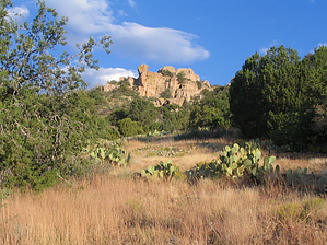


