Route Editor

| Guide | ♦ | 13 Triplogs | 0 Topics |
details | drive | no permit | forecast | map |
stats |
photos | triplogs | topics | location |
| 177 | 13 | 0 |
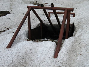
Great Alternative! by hippiepunkpirate  Mid to late spring is the best time for this hike because that's when Snowslide Spring is pouring out the most water! When the spring is flowing well, a small but magical stream flows down the mountainside at 11,000 feet above sea level and makes for a wonderful spot to relax. The end of this hike definitely has a different feel than the upper portions of the normal route up to the Weatherford. But have no fear, the route still passes through that oh-so-famous meadow that everyone associates as "THE Inner Basin." Mid to late spring is the best time for this hike because that's when Snowslide Spring is pouring out the most water! When the spring is flowing well, a small but magical stream flows down the mountainside at 11,000 feet above sea level and makes for a wonderful spot to relax. The end of this hike definitely has a different feel than the upper portions of the normal route up to the Weatherford. But have no fear, the route still passes through that oh-so-famous meadow that everyone associates as "THE Inner Basin."The route to Snowslide Spring is actually on a water maintenance road that allows the City of Flagstaff to access the catch via pickup truck. Pick up a copy of a Humphrey's Peak USGS Topo or check it out on MapDEX; they show the maintenance road going right up to the spring!
I did this hike with my dad on July 9th, 2008. It was a really wet winter with snowstorms into May, so the spring was still flowing marvelously. During a normal year, I wouldn't expect this to be the case in early July. Anyway, the first half of the hike is on the normal Inner Basin route. Park at the trailhead in Lockett Meadow and head up the Inner Basin Trail 2 miles to the fabled "Inner Basin Meadow." This is a magnificent place and always a good spot to take a breather. In the middle of the meadow at about 9,800 feet is a well pump station, with a maintenance road spurring off just before it, don't turn here. About a quarter-mile up the trail PAST the pump station, a sign will indicate the official Inner Basin Trail continues straight ahead; this is where you want to turn right. After another quarter mile or so, there will be another less obvious junction; make sure to veer left, and Snowslide Spring will be straight ahead. Along this section of trail, make sure to look over your shoulder every once in a while and enjoy the view. It's a narrow canyon you are entering, so the view from Snowslide Spring is a bit obscured by the canyon walls. When I came in July '08, there was so much water that the catch was overflowing and trickling even farther down the canyon. The catch is a good stopping point, but a faint footpath does continue up along the creek that flows into the catch. I followed until the canyon narrowed to the point where snow and water blocked my path. Some other hikers passed by and scrambled up one side of one of the walls, so it is possible to continue farther. My dad has stories from the '80s of camping (illegally) in of the cirques above and bushwhacking down to Snowslide Spring for water, so I know it is possible to get all the way out of the canyon. On our trip to Snowslide Spring, we saw two other groups of hikers, so it definitely gets some traffic. If you've already done the normal route up to the Weatherford, this is a great way to see the Inner Basin in a new light. Spring is the best time to come, with possible spring flow during the monsoon season as well. Autumn is also an option as you still get to see some fall colors, though the spring would probably be almost dry.
Check out the Triplogs. Leave No Trace and +Add a Triplog after your hike to support this local community. | ||||||||||||||||||||||||||||||||||||||||||||||||||||||||||||||||||||||||||||||||||||||||||||||||||||||||||||||||||||||||||||||||||||||||||||||||||||||||||||||||||||||||||||||||||||||