 Route Editor

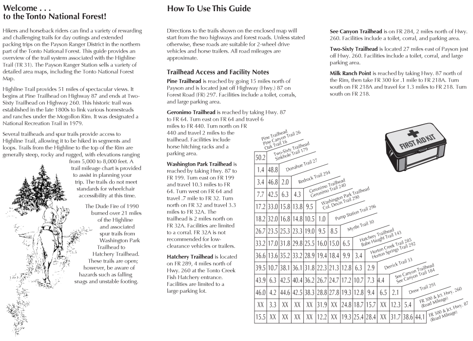
| Guide | ♦ | 116 Triplogs | 2 Topics |
details | drive | no permit | forecast | 🔥 route |
stats |
photos | triplogs | topics | location |
| 979 | 116 | 2 |
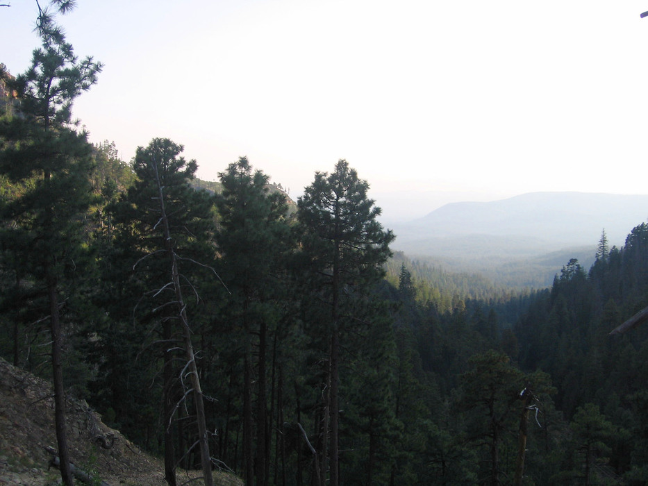
Great Gateway Hike with History Thrown In! by azdesertfather   Want a nice little hike up the rim with the pleasant sounds of the gently rolling stream waters next to you, and experience some of Arizona's history along the way? Then this is a trail to add to your list! With spectacular views, tall pines, majestic firs, and even at the right time of year some wild berries, how can you go wrong? Want a nice little hike up the rim with the pleasant sounds of the gently rolling stream waters next to you, and experience some of Arizona's history along the way? Then this is a trail to add to your list! With spectacular views, tall pines, majestic firs, and even at the right time of year some wild berries, how can you go wrong?History This trail is named after Colonel Thomas C. Devin, an Army officer who, in 1868, pioneered the route down off the rim. Fort Whipple military personnel led by Col. Devin used a trail in this location on a maneuver to find renegade Apaches. At the north access to this trailhead at Rim Road, there is an historical marker for the Battle of Big Dry Wash, wherein 1882 U.S. troops defeated a band of Apaches nearby after attacking some ranches in the vicinity.
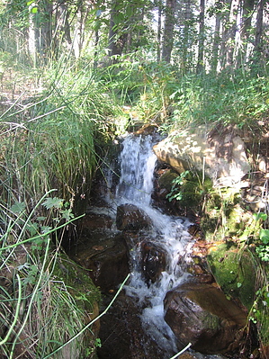
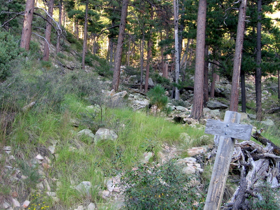
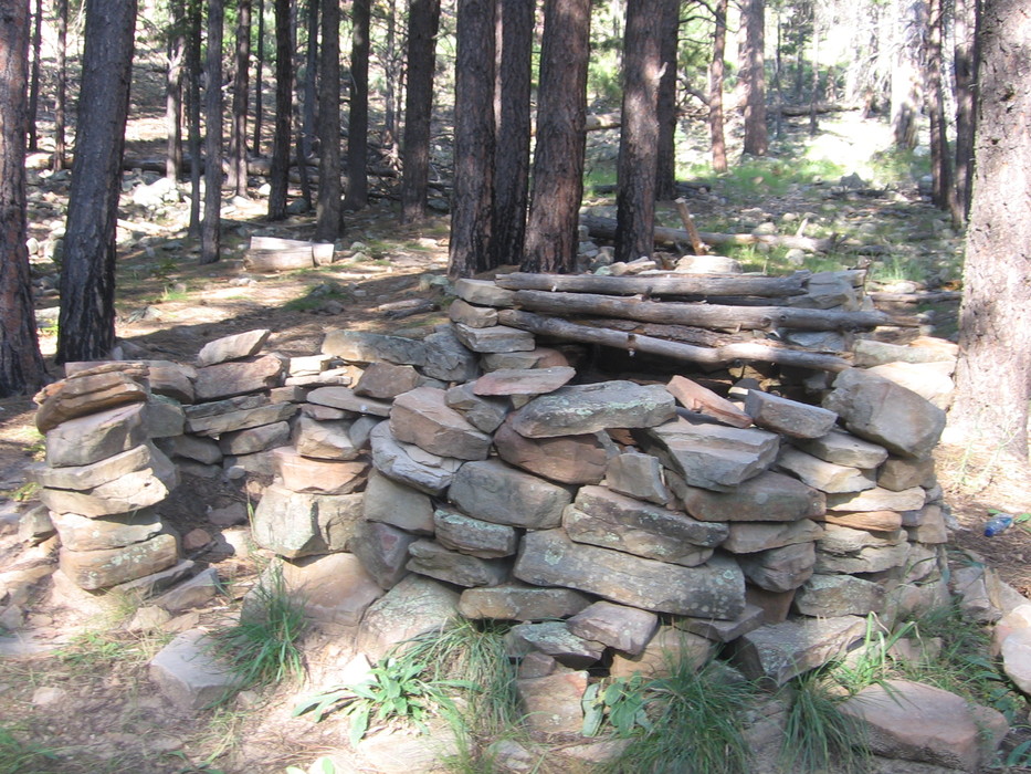
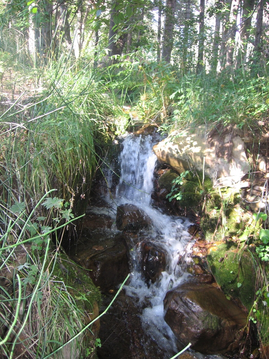
This trail is truly an excellent gateway hike. On the south end at the Washington Park Trailhead, this trail connects to the Highline Trail #31 and becomes part of the Arizona Trail at this point up to the rim's edge. On the north end at the Forest Road (FR300) Trailhead, there is access to a wealth of trails, including the General Crook Trail, Fred Haught Trail #141 (which has its south trailhead access adjacent to the north end of this trail), the Blue Ridge segment of the Arizona Trail, and many more. This trail also is the only established trail providing access to the historical Railroad Tunnel Trail #390, which terminates at a historic, uncompleted railroad tunnel and powder house remains. I saw no one on the trail or at either trailhead on my outing. Hike The Col. Devin trail is accessible from trailheads at both its north and south ends. Since most I suspect will use the north access, the guide will begin from this trailhead ( reverse ). At the trailhead sign, on the south side of FR300 (across from the monument commemorating the Battle of Big Dry Wash), the trail begins. Follow the trail as it parallels the power lines to the west. Trail reconstruction on some of the upper sections has changed some of the route. I suspect that the original trail followed the power lines all the way (as this is a water pipeline and powerline access road). Still, today the trail "officially" does not follow this road all the way (plus, it provides convenient access to the Railroad Tunnel Trail). Deadfall from old fires lies scattered throughout the area; thankfully the forest has been returning and is quite beautiful again. At the second power pole, don't miss the turn to the left (the trail leads away from the power line). Shortly after descending the rim and making this turn to the left, there is a gate on the trail; please reclose it on the way down! (Note: there is also another similar gate that goes perpendicular to and underneath the power lines. If you come to this gate, you have just missed the turnoff; look back and to your left, and you should be on the right path!) Soon after passing through the gate, you will come to a small wooden sign noting the turnoff to the Railroad Tunnel Trail #390. There are also some switchbacks in this area. If detouring from this hike to the tunnel, it is another quarter-mile of trail back up the rim and terminates at the historic, uncompleted railroad tunnel and powder house remains. Continuing past the Railroad Tunnel Trail turnoff, the path winds down, descending past another open-air rock structure before veering to the right and back to the larger path alongside the power lines. (For those coming up from the south, there is a small sign marking this turnoff veer to the right.) The trail will soon get much closer to and parallel a part of the East Verde River as it descends to connect with Ellison Creek. Some of the most colorful and beautiful butterflies I have ever seen were in this south half of the trail, and others have reported at the right times of year to find wild berries (including raspberries, I am told) here as well. There are numerous little rushing waterfalls and rapids (keyword "little," most of the time)...nothing big, but enjoyable to view and listen to, too. This part of the trail is less steep. As you get close to the Washington Park Trailhead, you will encounter one section of the water pipeline exposed as it goes over a wash. Just before reaching the trailhead and parking lot, there is a turnoff to the right for those continuing on the Highline portion of the Arizona Trail. Hikers, horseback riders, and mountain bikers are permitted on this trail, although the latter two are not recommended. This trail is steep with loose footing in several areas. Gate Policy: If a gate is closed upon arrival, leave it closed after you go through. If it is open, leave it open. Leaving a closed gate open may put cattle in danger. Closing an open gate may cut them off from water. Please be respectful, leave gates as found. The exception is signage on the gate directing you otherwise.
Check out the Official Route and Triplogs. Leave No Trace and +Add a Triplog after your hike to support this local community. One-Way Notice This hike is listed as One-Way. When hiking several trails on a single "hike", log it with a generic name that describes the hike. Then link the trails traveled, check out the example. | ||||||||||||||||||||||||||||||||||||||||||||||||||||||||||||||||||||||||||||||||||||||||||||||||||||||||||||||||||||||||||||||||||||||||||||||||||||||||||||||||||||||||||||||||||||||||||||||||||||||||||||


